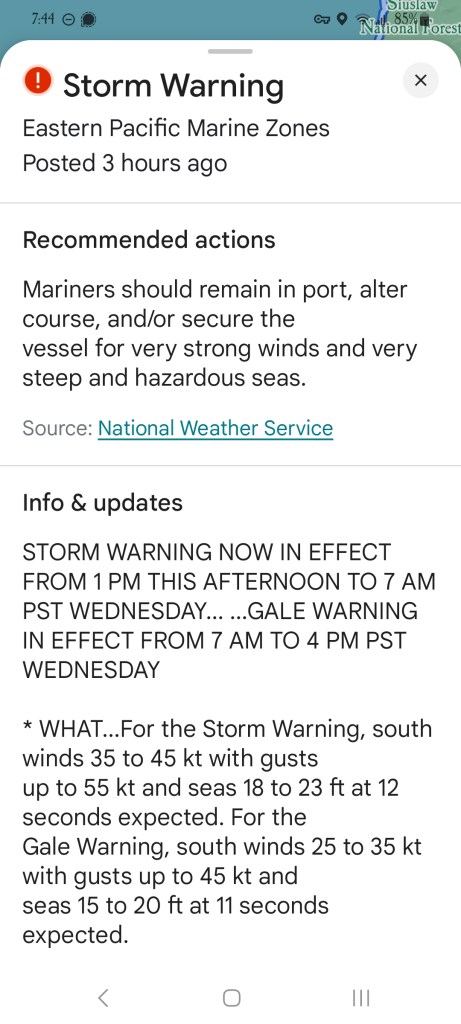
Guessing the mileage is near 2,500 miles. It was 2,200 yesterday and I forgot to mention it, and I put on ~240 miles today, so.. I’m not catching the round numbers very well. I don’t care. Passed a sign today that warned of “sunken grade” which apparently is notifying that the earth under the road has either slid away, or could at any time. So a live slide warning, I guess. The first fun was the Storm Warning that google said could impact my trip. I’m imagining getting gale force winds blowing me off the cliffs.
I thought the coast was going to be exhausting because I would spend all day doing twisties on the roads, but it turned out there are a lot of small towns on the coast. A whole lot. Some of them cute, some of them boring, some of them large enough to have fast food joints and Valvoline oil places and Walmarts. Kinda breaks the mood. And why are there so many Mercedes here? And why are they so slow. Actually I think I can guess on the latter.
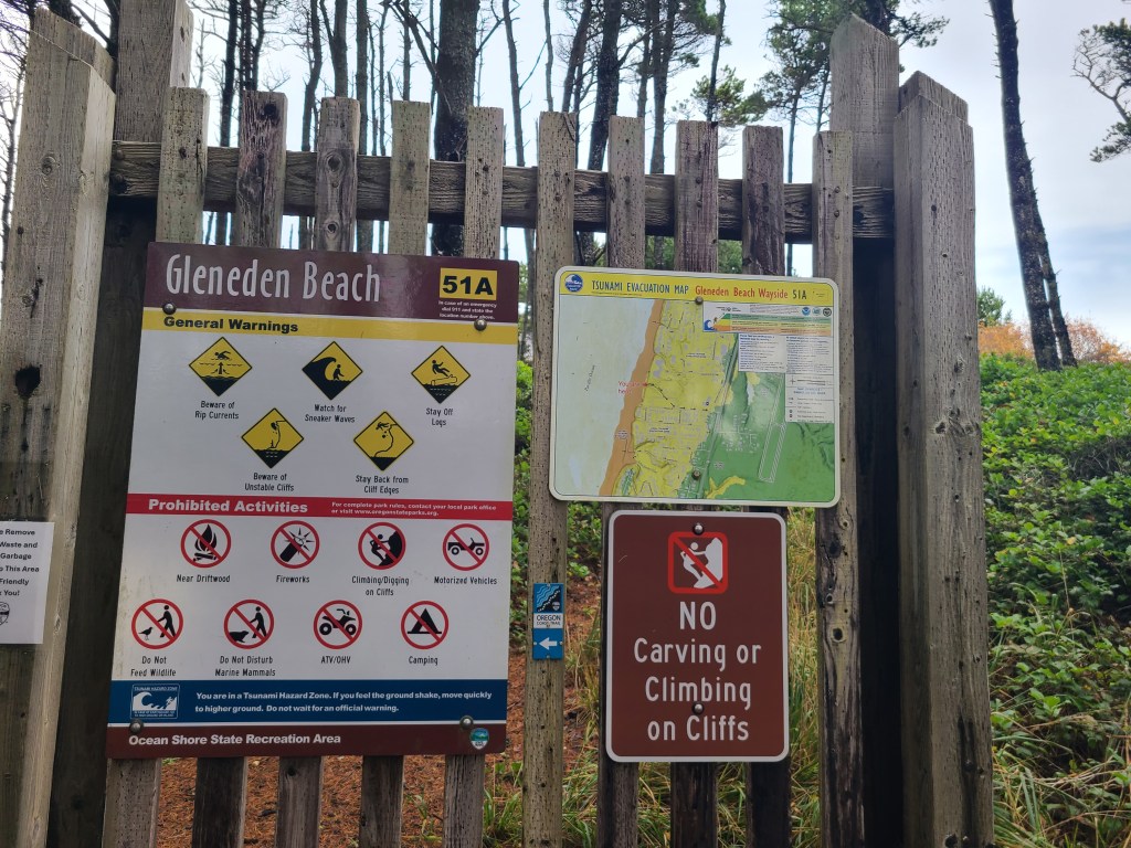
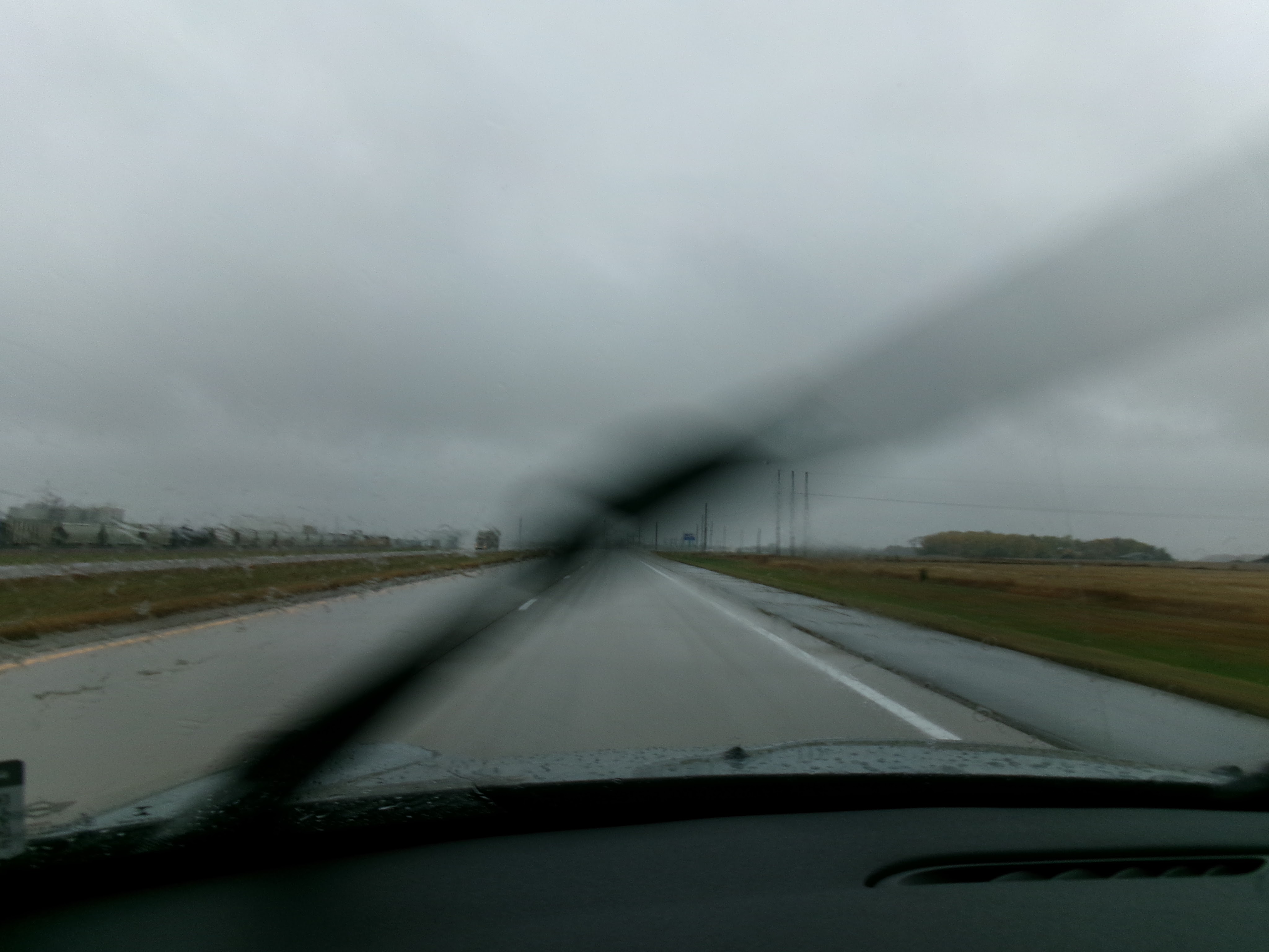
I really enjoyed it when the roads became constantly twisty. Up, down, left, right. Cliffs going up on the left, deep dropoff on the right. Sometimes in the woods, where it gets nice and spooky. There was rain much of the day, and they threw in some fog just to sweeten the deal. Having seen Elk warning signs and Tsunami hazard zone signs, that get you:
It got dark enough with all of the above that my car went dark display thinking it was night time. Speaking of night time, I went out tonight to get dinner and it was dark and raining and I didn’t like it one bit. I’m old.
And I don’t quite know why, but I felt like Keanu Reeves at the end of (spoilers!) Point Break. Driving from beach to beach during stormy weather and downpour, looking for that lone surfer he can arrest. But doesn’t.
Tomorrow I’m off to Eureka, California. As of 2022, Humboldt County ranked fourth out of California’s 58 counties in missing adults per capita. You can prepare by watching Murder Mountain on Netflix. For some reason you can’t share that, so search it yourself.
One last last note. A certain sister questioned whether or not I’m the bigger boat nerd. To that I ask, how many boats have *you* built? (Yes, I understand I’m participating in a sibling war via blog)
Weather: Cool, but partially sunny, giving way to drizzle and then just screw it downpour.
Budget: Food well below, Hotel below
Food: Latte, Donuts, Burrito, Egg Nog
Music: 90’s alt hits playlist, Beastie Boys – Ill communication, Alice in Chains – Dirt, Pearl Jam – Ten
Observations
Really appropriate quote from the Roman philosopher Seneca, but I got it from a lyric in a Semisonic song: “Every new beginning comes from some other beginnings end”
Seaside Oregon is a totally cute little town, tiny streets, felt like the french quarter, but at a smaller scale.
Teenage Dirt-bag by Wheatus is my favorite little lesbian love song.
Cruise control doesn’t just keep you at speed on the highway, it actively maintains your speed. So if you’re going down a mountain pass, it downshifts for you. No brakes needed!
My blank magnetic ring for deactivating my VNS broke. Don’t worry I have two more with me, but they’re not goth black.
The pronto pup was invented in Rockaway Beach
Went through Tillamook, where they make the cheese, saw the creamery. Probably why I missed the lighthouse.
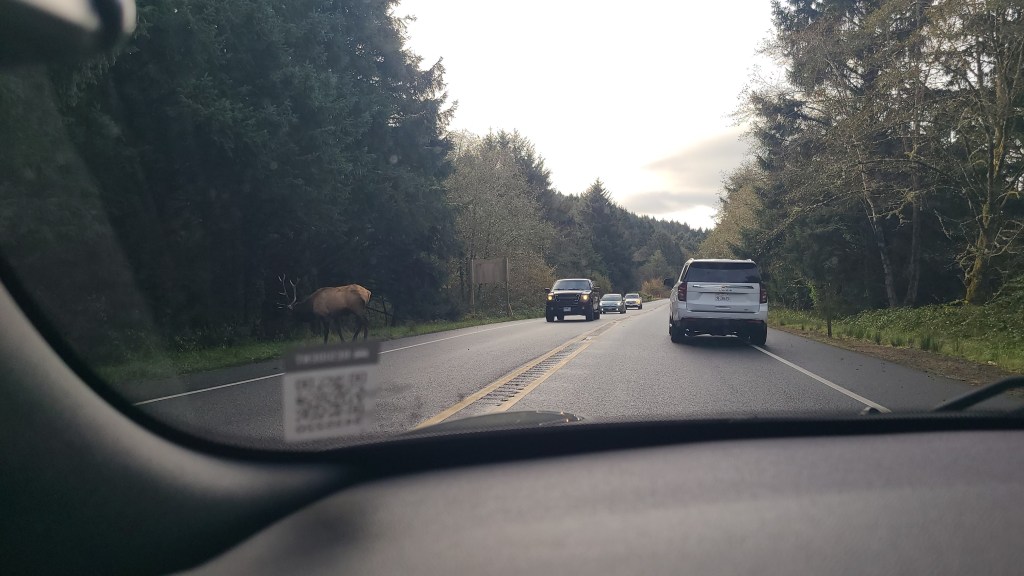
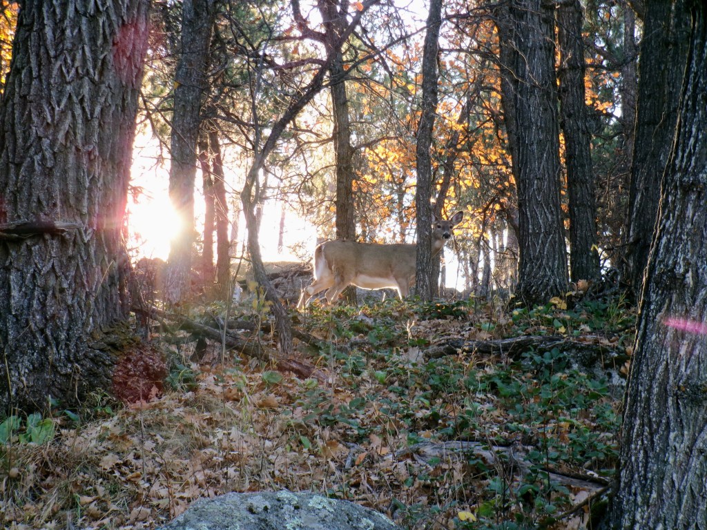
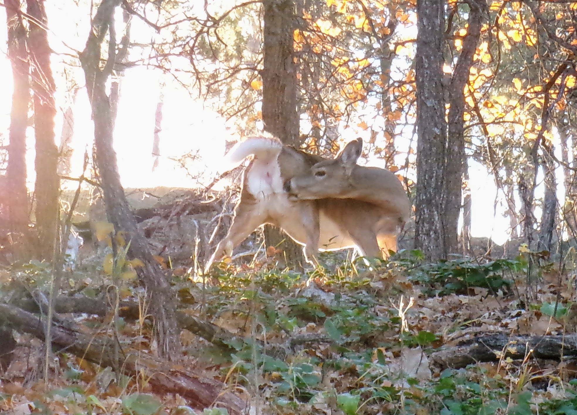
If a many point Elk buck is standing in the road, everyone just stops and waits. Nobody gets out to shoo it, we all just know our place and wait. Much like Bison. After the big guy wandered into the woods, I passed at least half a dozen other Elk just chilling, grazing, sitting or laying on the side of the road. Seeing Elk instead of Bison feels cooler because they’re in the wild, whereas Bison are often on a farm or managed in some way.
Pictures
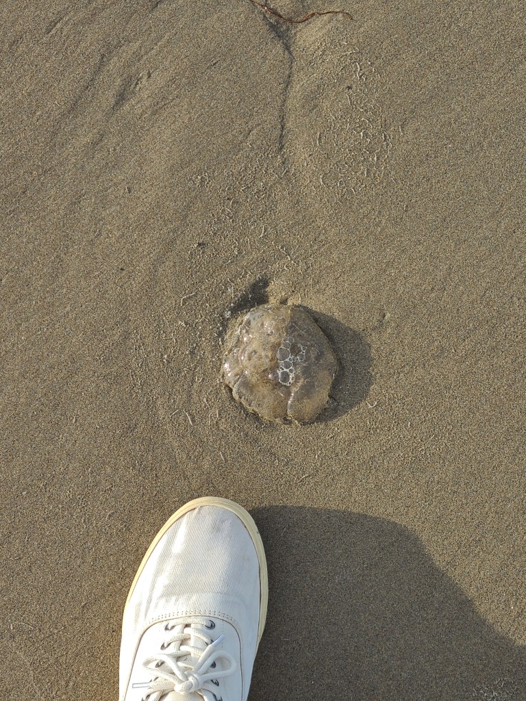
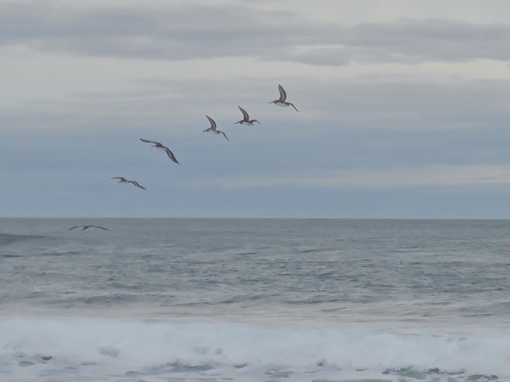
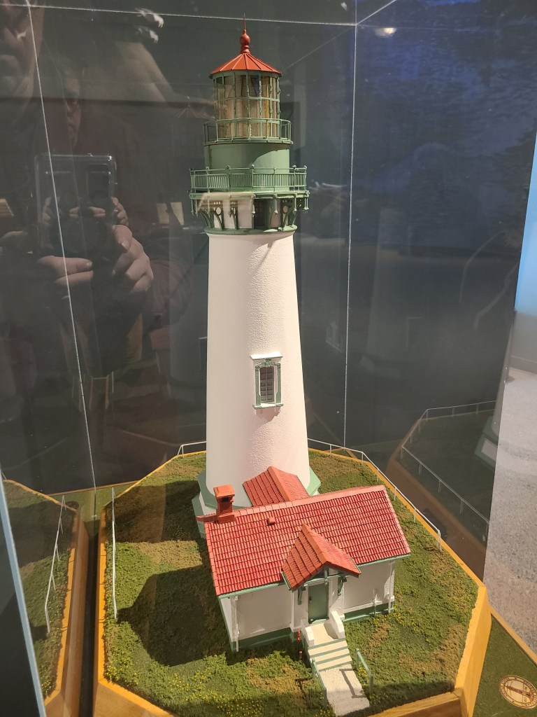
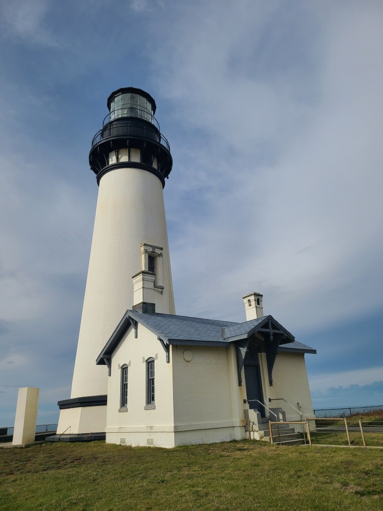
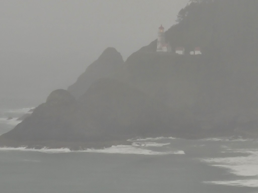
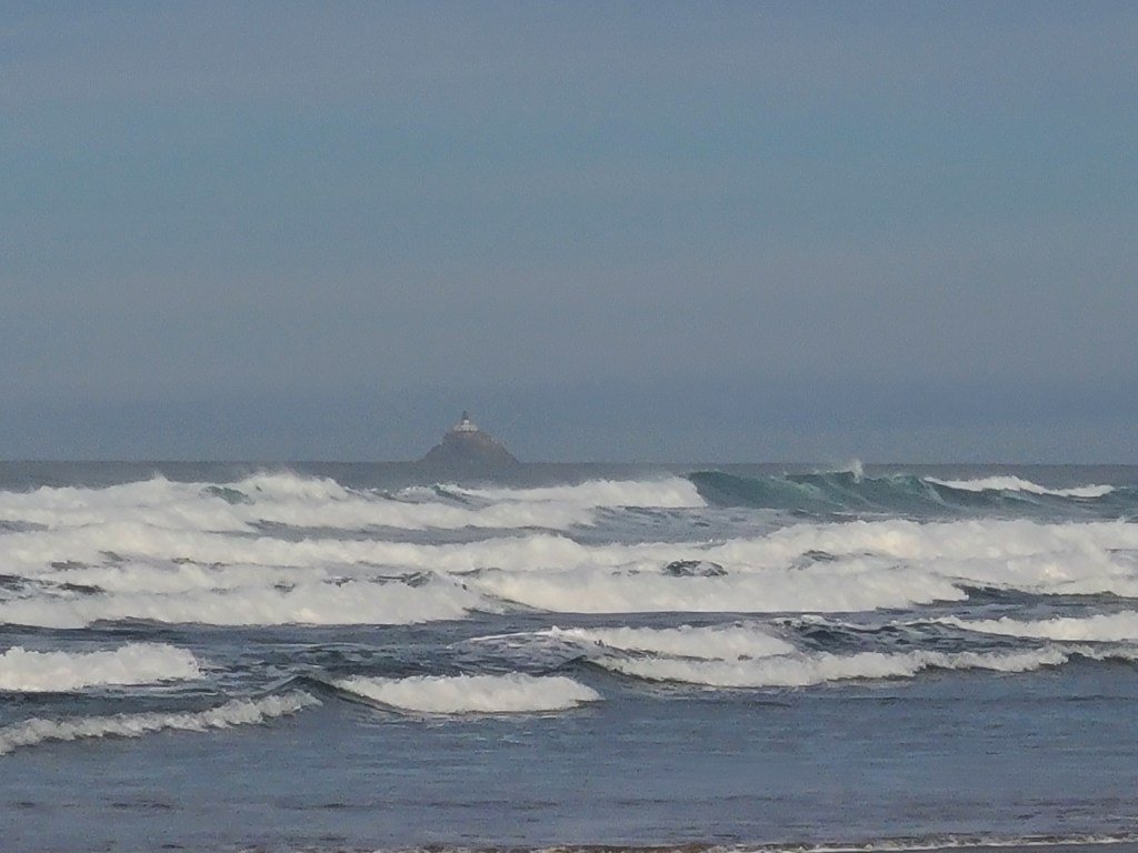
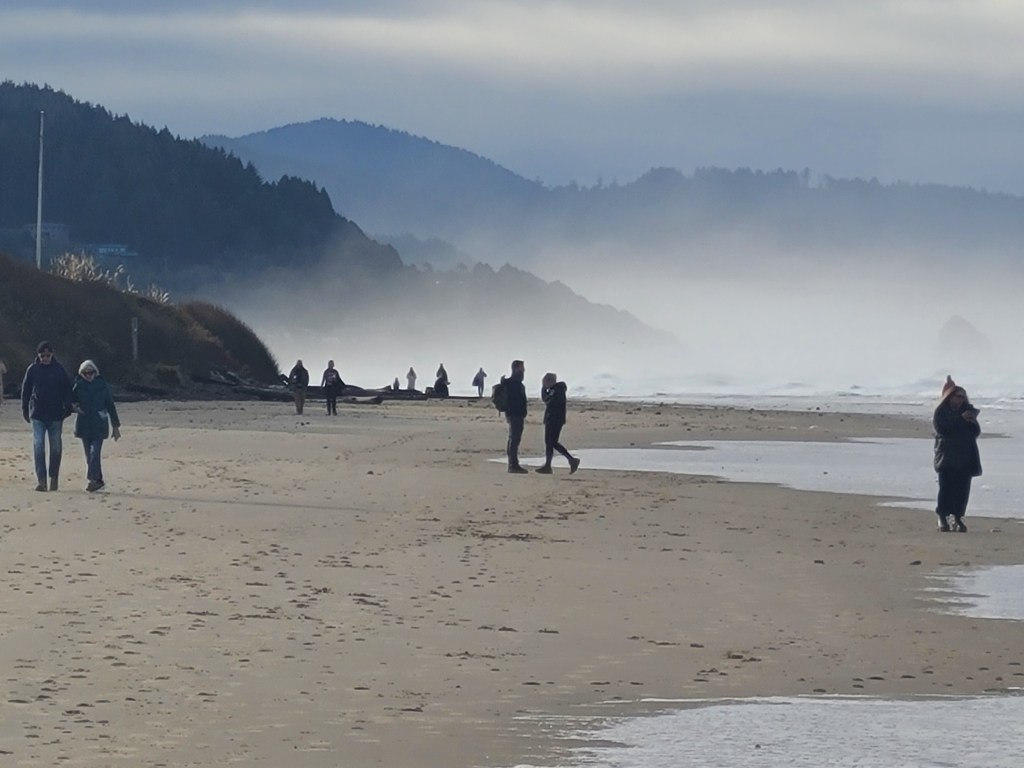
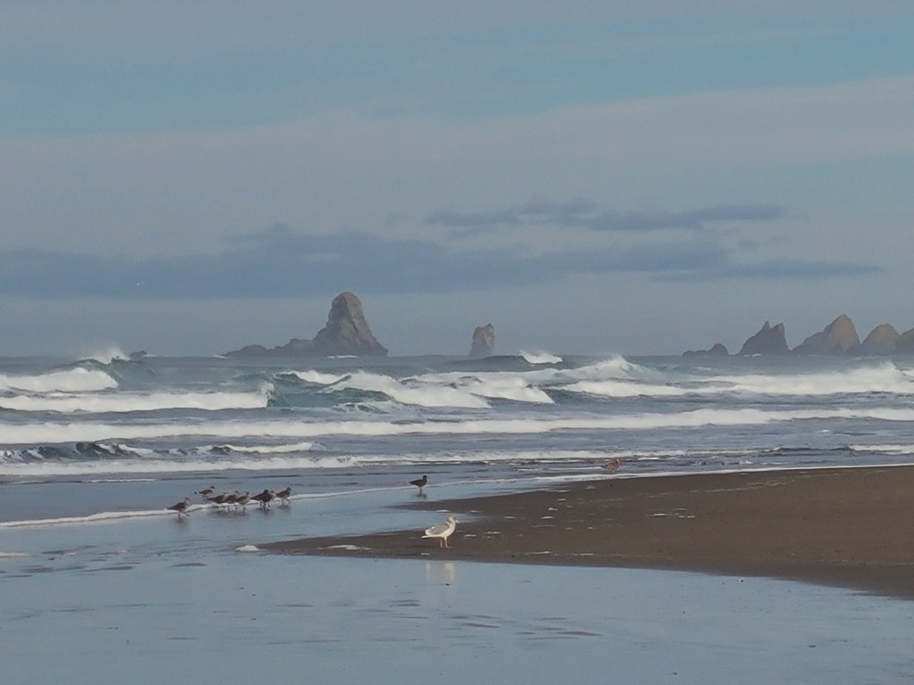
That’s an invertebrate! (foot for scale)I can’t identify these birds. They don’t look like Pelicans, nor were they flying like them but that’s what Merlin says.My buddy the moose, er, Elk.Lighthouse modelModel LighthouseBeaches are complicatedLonelier Light house
That means do nothing but laundry day. Got up late. Well, late for the tip, eight.
First, I went for coffee.
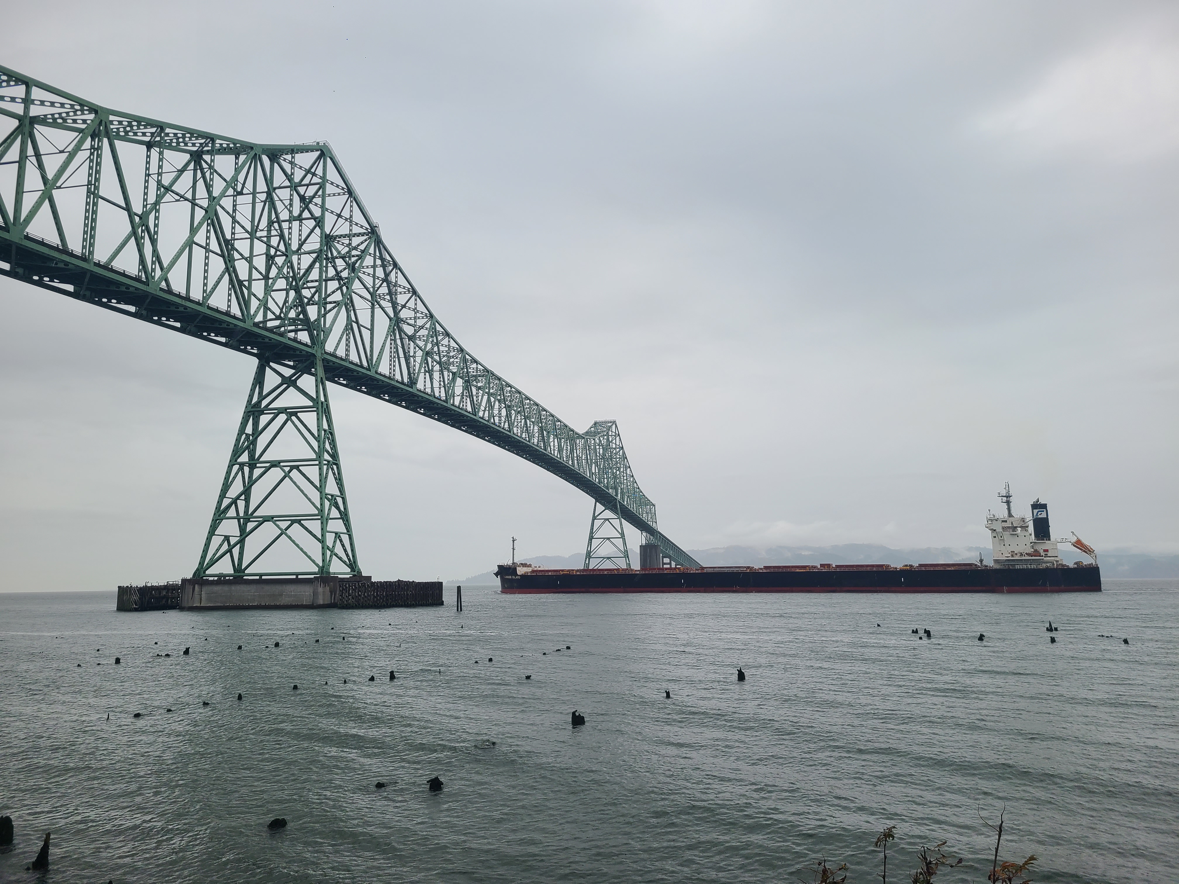
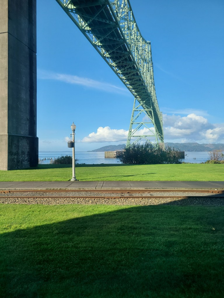
On the way to the Maritime Museum I saw a boat and decided to chase it down to the bridge, so I could send a picture to my boat nerd sister. (I’m a bigger boat nerd, but she rates.)
And then I doubled back and went to the Maritime Museum. It was incredibly awesome.
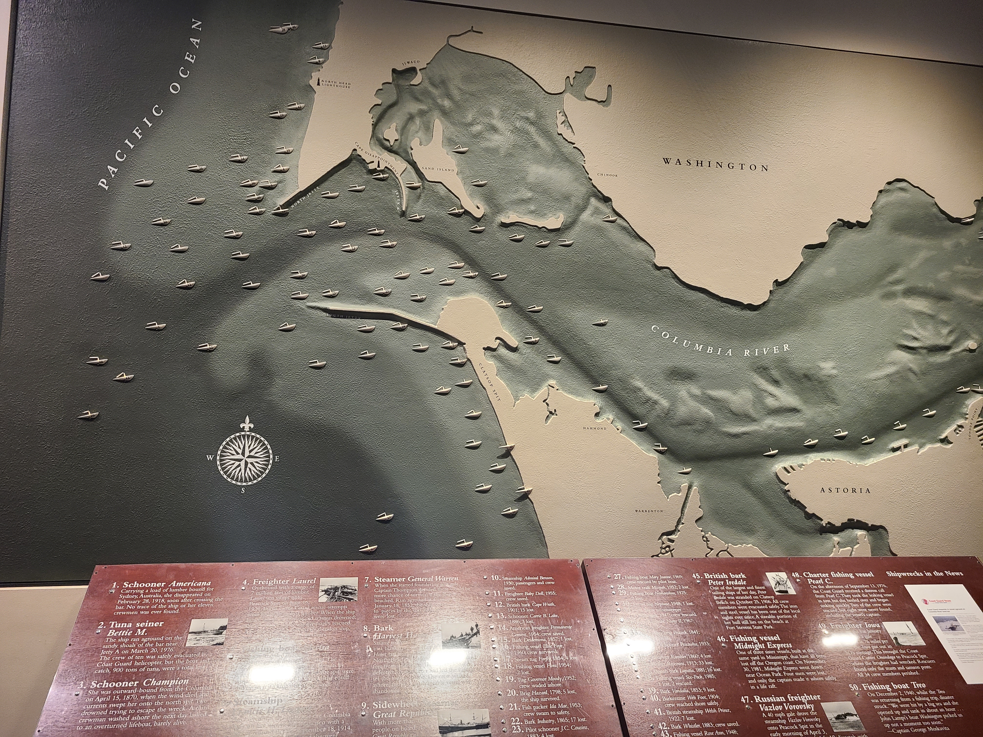
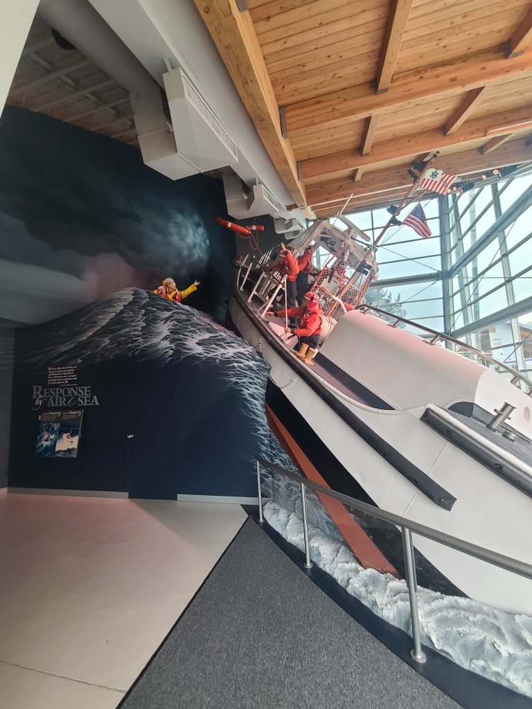
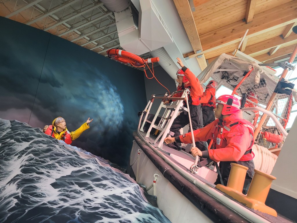
Where the Columbia river meets the ocean, there are sandbars which are moving on the regular. This is a map of shipwrecks. It’s hard going from one environment to the other, even before you add in near constant rain, perpetual fog banks here and there, and unpredictable high winds.
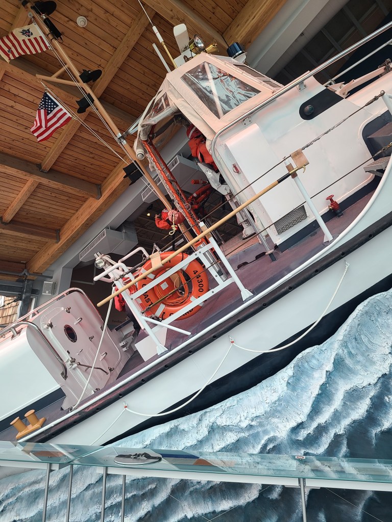
The Coast Guard is amazing here. It’s one of the most challenging missions for them, and they rescue over 600 people per year. Crazy. Check out that particular crazy:
I was going to point out that those images weren’t tilted, but that last one is. In the favor of the boat. It’s actually a steeper angle.
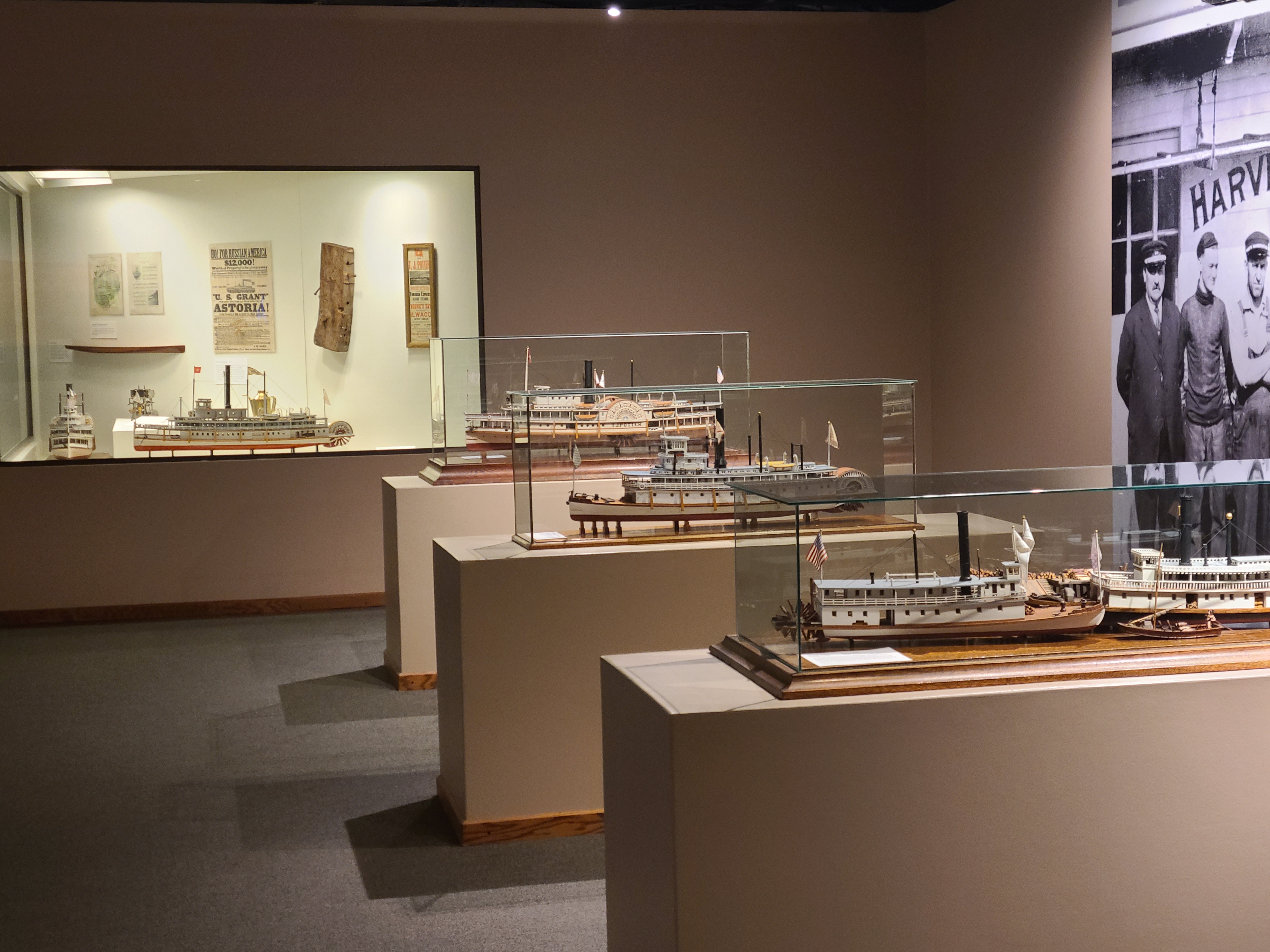
Finally, among the multitude of excellent exhibits, they had the required “little model ship room.” When I was little and my Dad and I went to the Maritime Museum in Duluth – every single time we were in Duluth – I stared at the models there for so long. Imagining the real vessel and what that much be like, who the crew was, and what it would be like to work and live on a boat like that. I also wondered at the detail and craftsmanship, liking to build models I was in awe at their scale model builds. And of course I imagined having little action figures and playing with them on the boats.
I did not have the requisite magnet of Oregon, so I went up to the Astoria Column on top of the hill. It’s a column. You can climb up it and get. an amazing view if it’s not raining and/or foggy. So I passed on that. But I did hit the gift shop and get my magnet. I found out they sell balsa glider airplanes in the gift shop, and you’re allowed to throw them from the top and see how far they go. They’re biodegradable, and some have made it as far as the water, which is nowhere near the Column.
And that’s it. I went back to the hotel, made a bunch of reservations for hotels for the coming week, and did a load of laundry. Back to the coast tomorrow for some proper Ocean time. Although I will stop at Starbucks on the way out of town, as I won’t be seeing any chain food for the next many days. Or phone signal. Yay!
I have always been fascinated with MSH. It erupted when I was in grade school and I think it was the first time I understood that nature can whip your ass any time she wants to. My Dad went to Seattle for work about a year after and brought back a pen with real MSH ash in it. I was fascinated.
I made a trip to Portland for a friend’s wedding, and I wasn’t able to go see it up close, but you could catch a glimpse on a sunny day, so I saw it from afar. And I knew I was going to be in the neighborhood, so it ended up being the Site of Interest of the day. Digging around on google maps I understood what was open and what wasn’t. The best viewing spot, the Johnston Ridge Observatory, was closed. Actually the whole road leading up to it. But there was a National Parks (foreboding music here) visitor center, so I figured that would do. Then the shutdown happened and it looked like there would still be a parking lot to see from. So that was the plan.
Something stopped me
Looking for other roads that might get me a view, I found a pass that was closed, as well as a bridge that was closed at the end of it. So that was out. But as I was heading to MSH, a highway sign for the closed road showed itself. And it didn’t just have the road number, but it said Mount Saint Helens. I couldn’t skip it. I just had to see how far access would let me go. Both google and the car GPS units were freaking out, telling me not to go that way, and agreeing on the spots I should turn around. I let them argue. I wasn’t going to stop until something stopped me.
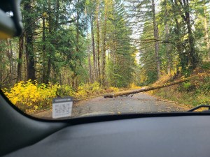
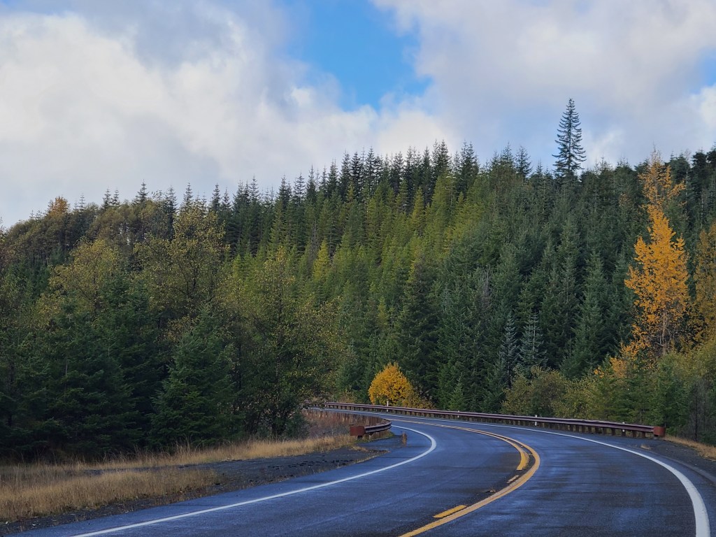
The road was rough but in decent shape, clearly not a lot of traffic came by here. There were a number of spots where a tree had fallen across the road but had been chainsawed into submission. Some of the patched areas were teeth jarringly rough, but few and far between. Slowing down for curves was less about going off the curve and more about being prepared if another car was coming the other way. The road was just more than one lane wide. It was so much fun! Up and down and left and right! But after five miles the signs saying it would be closed were more frequent and looked more confident. But it wasn’t an official chain across the road that stopped me, it was a tree.
Worth it. I turned around and did the same road back and enjoyed every mile as much as the first. Ended up at the original highway and slipped back into my route. It was over an hour to get to MSH proper from there. Big stuff.
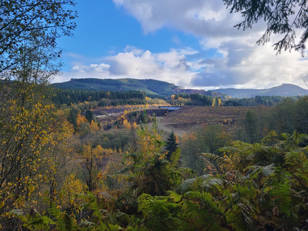
On my way in, I stopped at a sediment dam. They had a great explanation on an overlook. It’s a dam to hold back the (duh) sediment, but allow water to get through, and I think they were even trying to let fish who spawn upstream get past it. There was a lot of sediment from the original blast. But what impressed me was the fact that there is still so much still up on the mountain that they pulled the whole “one foot thick highway around the world” statistic type thing.
A big further down the road I stopped at the Hofstadt Creek Bridge viewing area – not for viewing MSH, but for viewing the bridge. It’s a very nice bridge, I must say. It is at the edge of the blast zone. You haven’t even seen MSH yet. It’s still 15 miles away. That’s crazy.
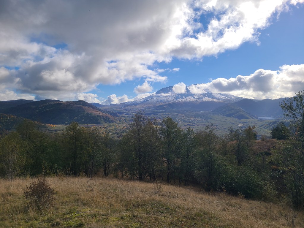
I wasn’t sure if I was seeing MSH though. I knew it was a volcano with a whole side blown off, but i wasn’t sure if it was fully grown over with trees or not. So I was seeing these giant hills around me and trying to suss it out. I was also preparing myself for an overlook showing me it was three green hills in the distance, and that not everything is as impressive as they make it out to be. At that overlook I was thinking about how quiet it was, and how very nature-like the scene was. Given my affinity for the mountains, and now these Washington forests, I was beginning to consider how sad it was that so much nature had been flattened by the eruption. I know it’s the cycles of nature, but still. It was not lost on me that there were people camping in beautiful spots like the area around me, when suddenly an explosion wipes them out. That would be a horrible surprise.
I finally make it down to the areas I was trying to get to, and the National Parks had not only two sections closed, but they even closed the parking lots. So no free view here. Jokes on them though because the Castle Lake viewpoint was open, and that was my backup. The roads around the National Park were extensive. They looked like they were built for heavy traffic and vacationers. This being the shoulder armpit season, nobody would have been here anyway, but I had to wonder how busy did it still get? The eruption was 40 years ago. I remember it as a kid, but none of the kids today knew it that way.
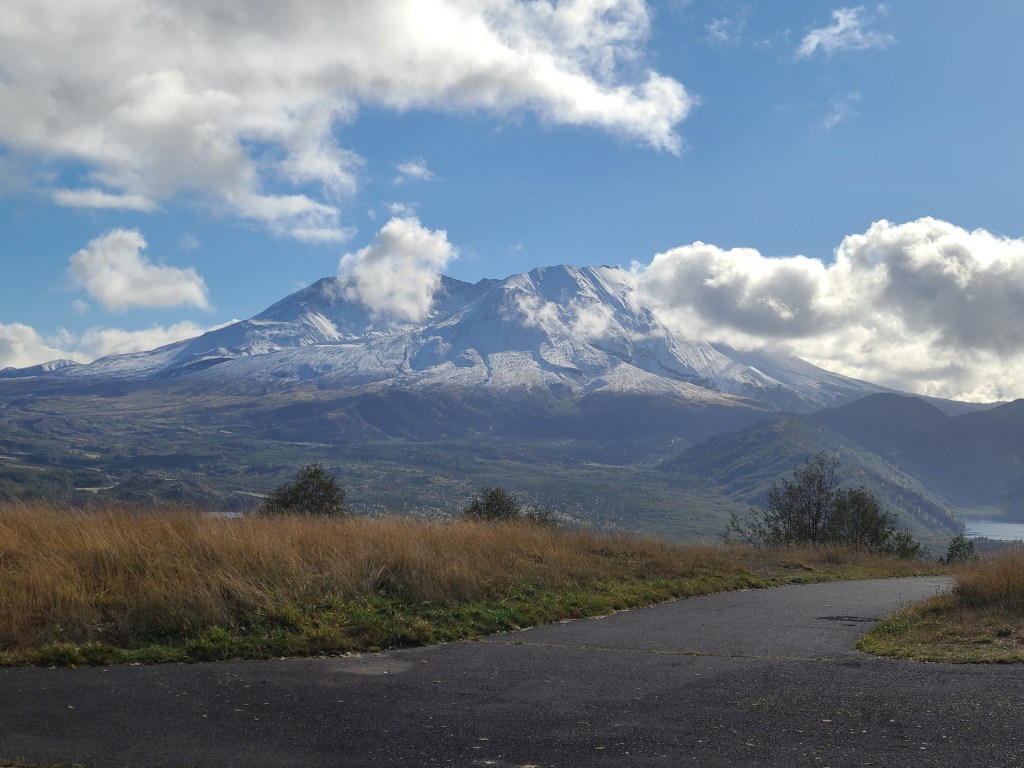
I head back to the Castle Lake viewpoint and the view was phenomenal. And MSH was not a few green hills. It is still a mountain to be in awe of. It was covered in snow, and the clouds seemed to have to slide around the mountain, it was that big. I took pictures, but honestly I was frustrated at the inability of a picture to capture the majesty of it all. Not just the mountain, but the valleys around me, and the sheer scale of it all. Once again, nature was so overwhelmingly impressive that it made me want to throw up. In a good way.
I would like to thank the Forestry Service for such a wonderful viewpoint, and keeping it open for me and the other six people who were in the area today. Not that I saw any of the others, they were just in the area. I was blissfully alone in my experience. Also, I use a recorder to record notes for later, and I just noticed that I was whispering any time I was in nature. Respect.
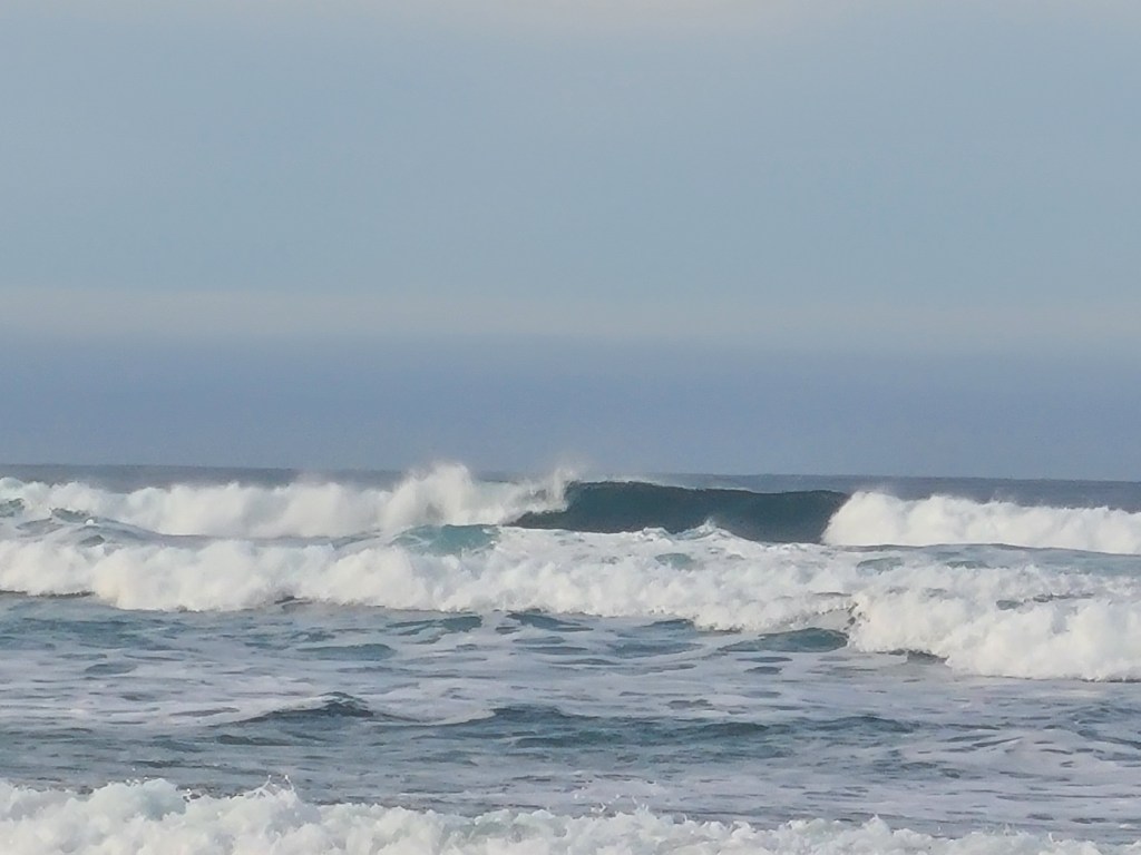
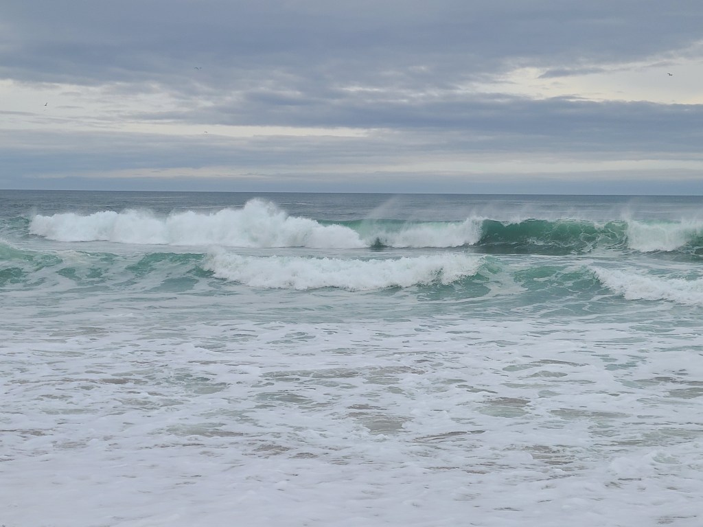
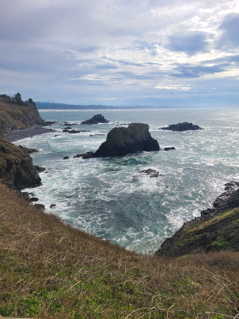
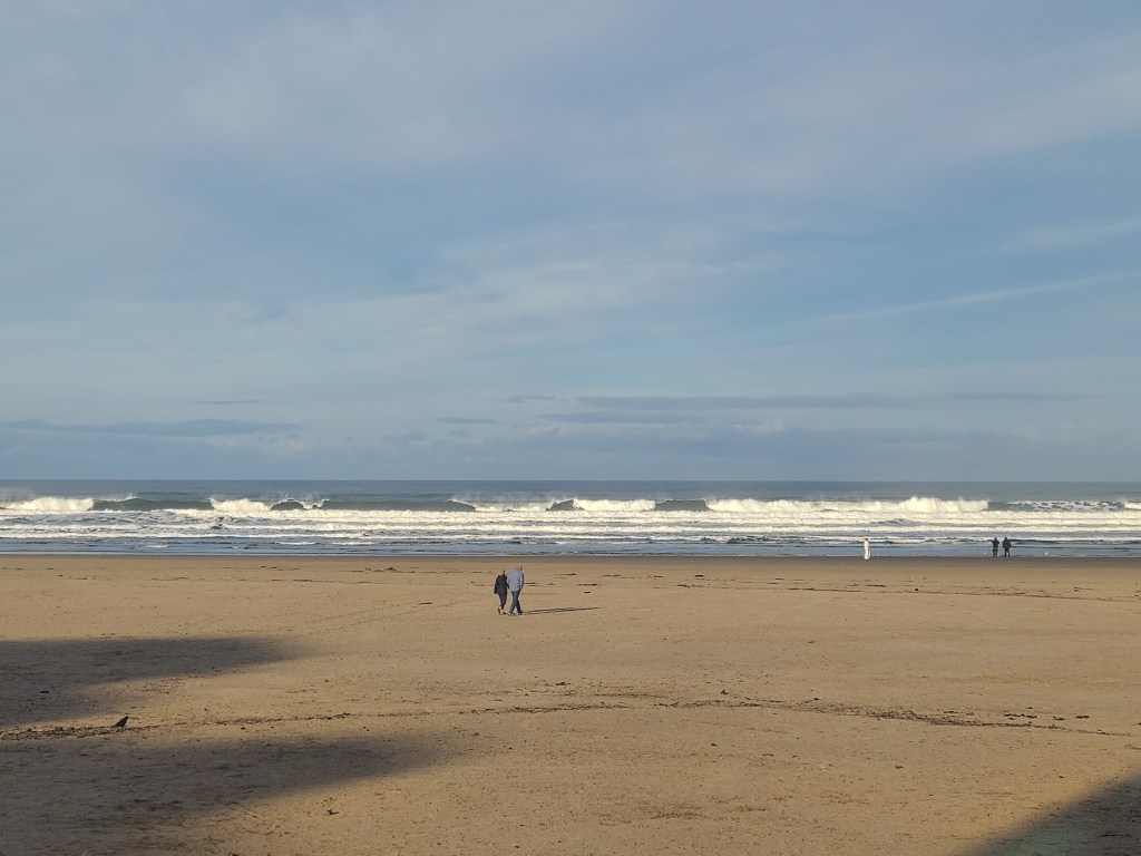
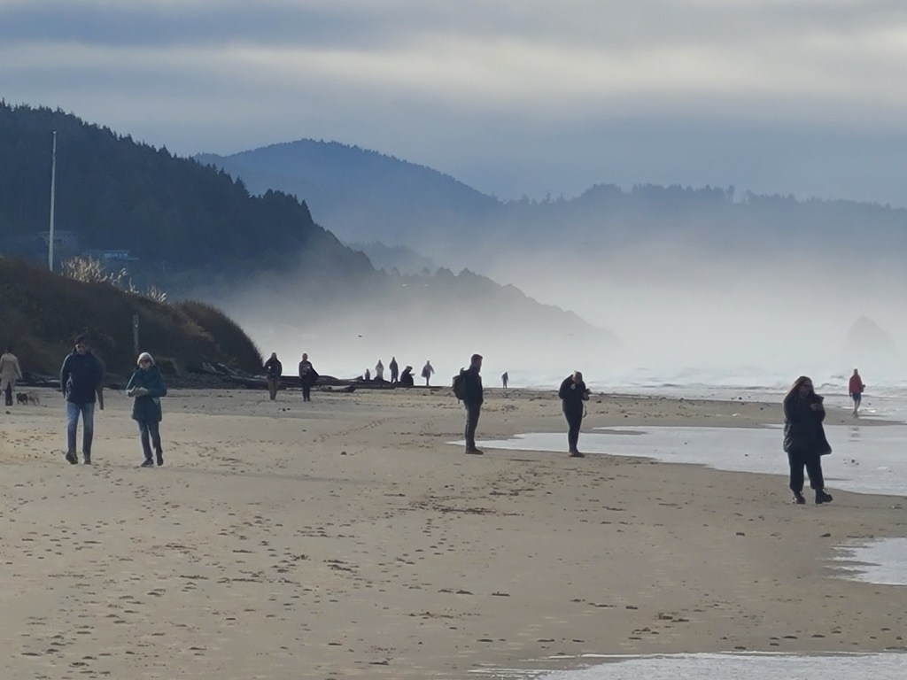
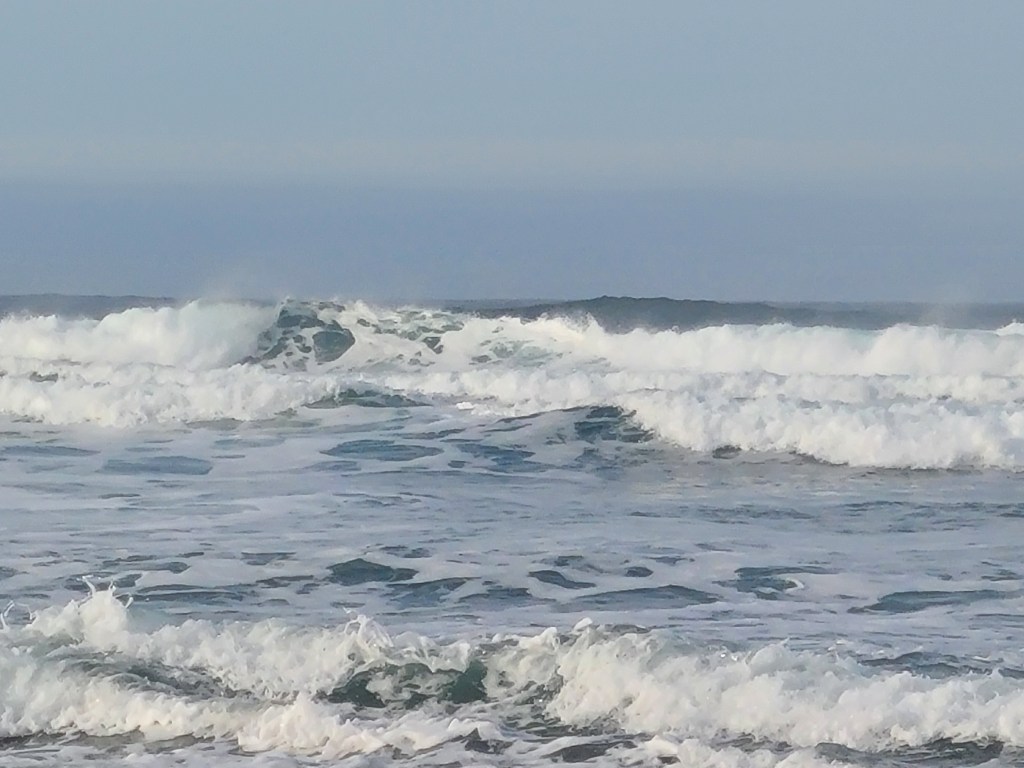
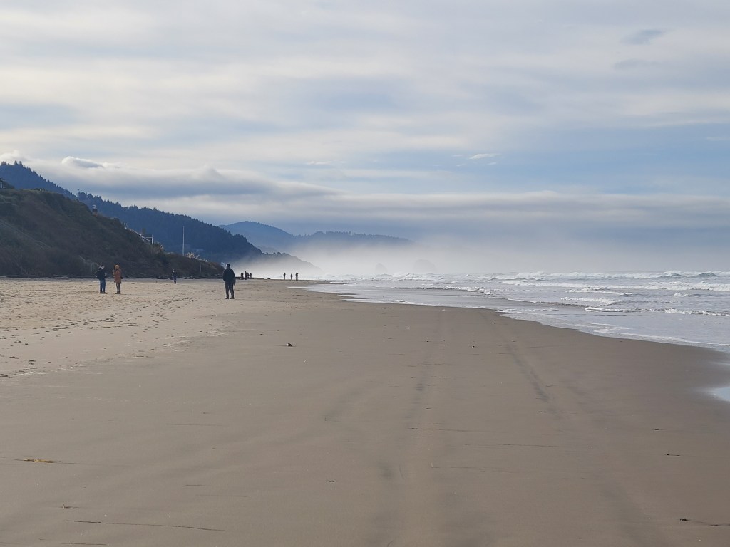
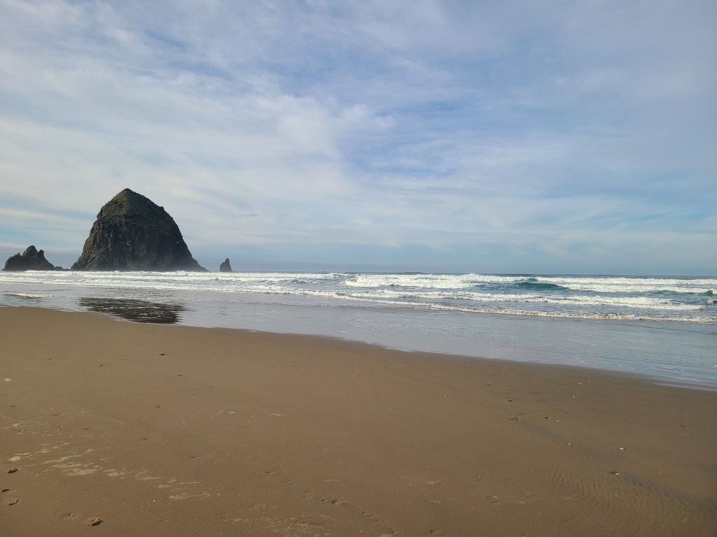
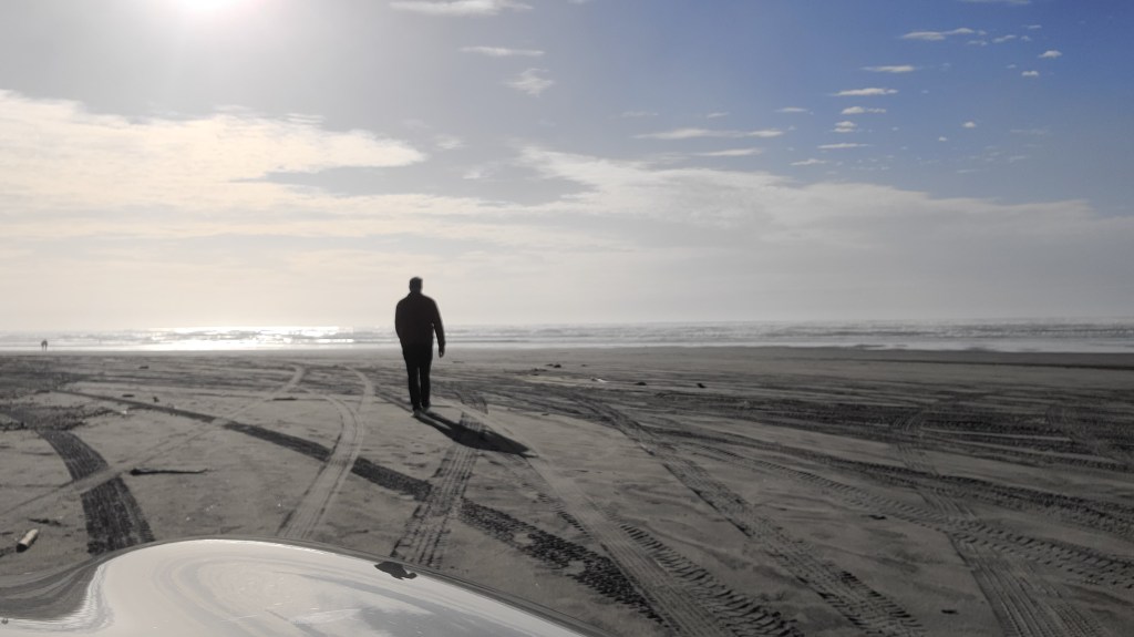
The Ocean
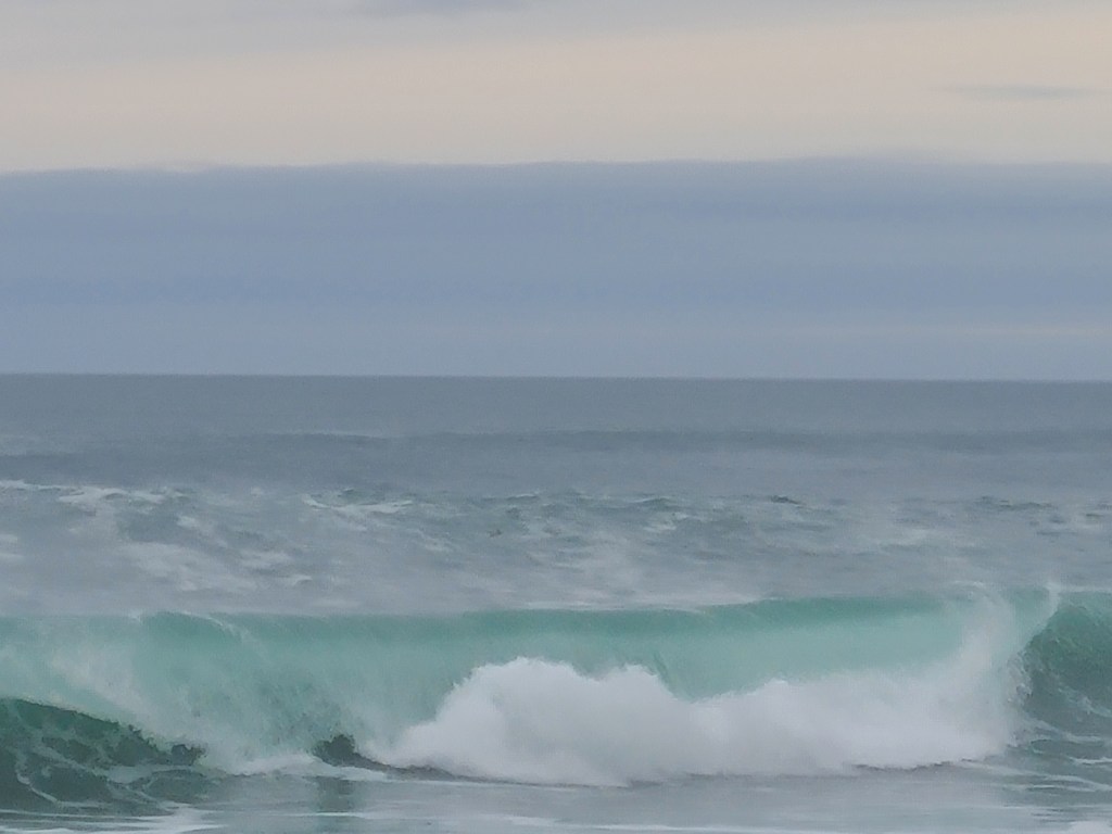
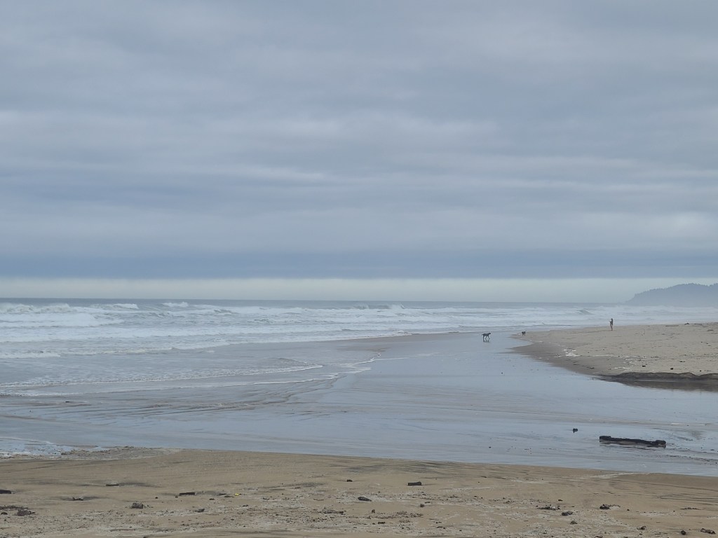
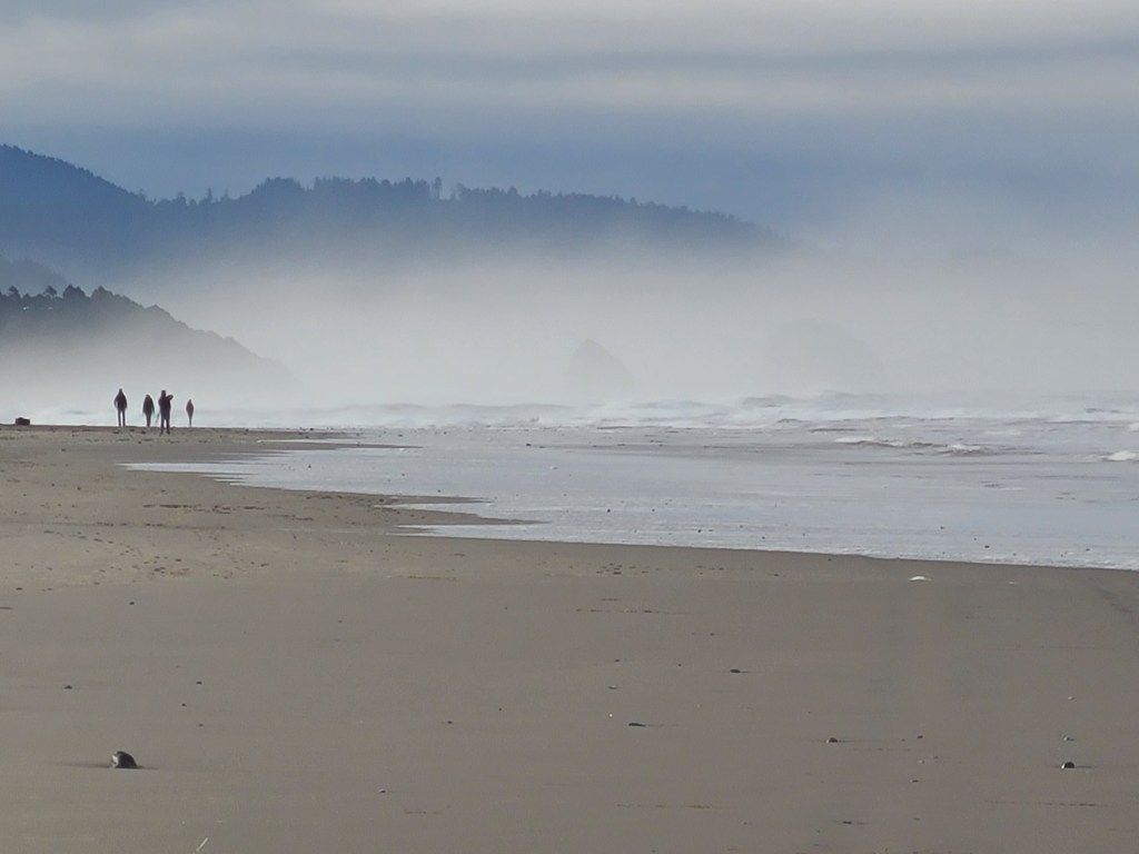
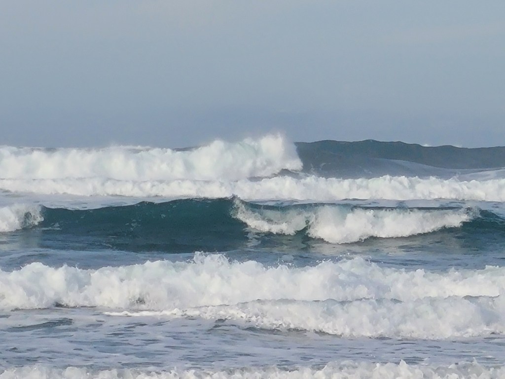
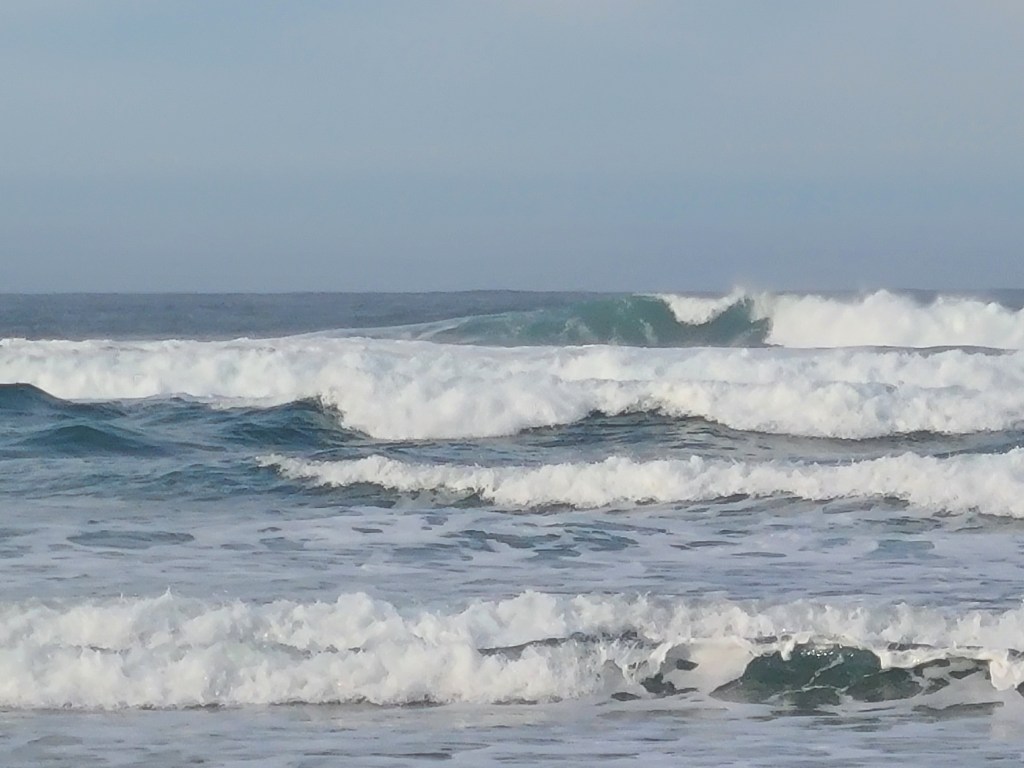
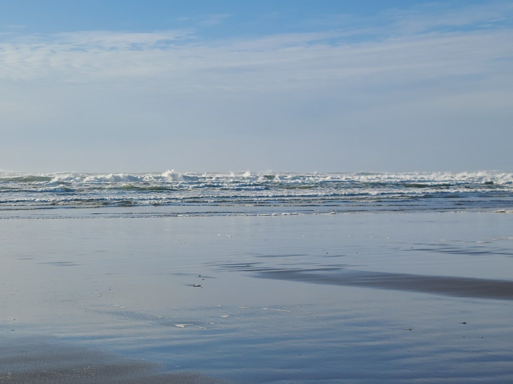
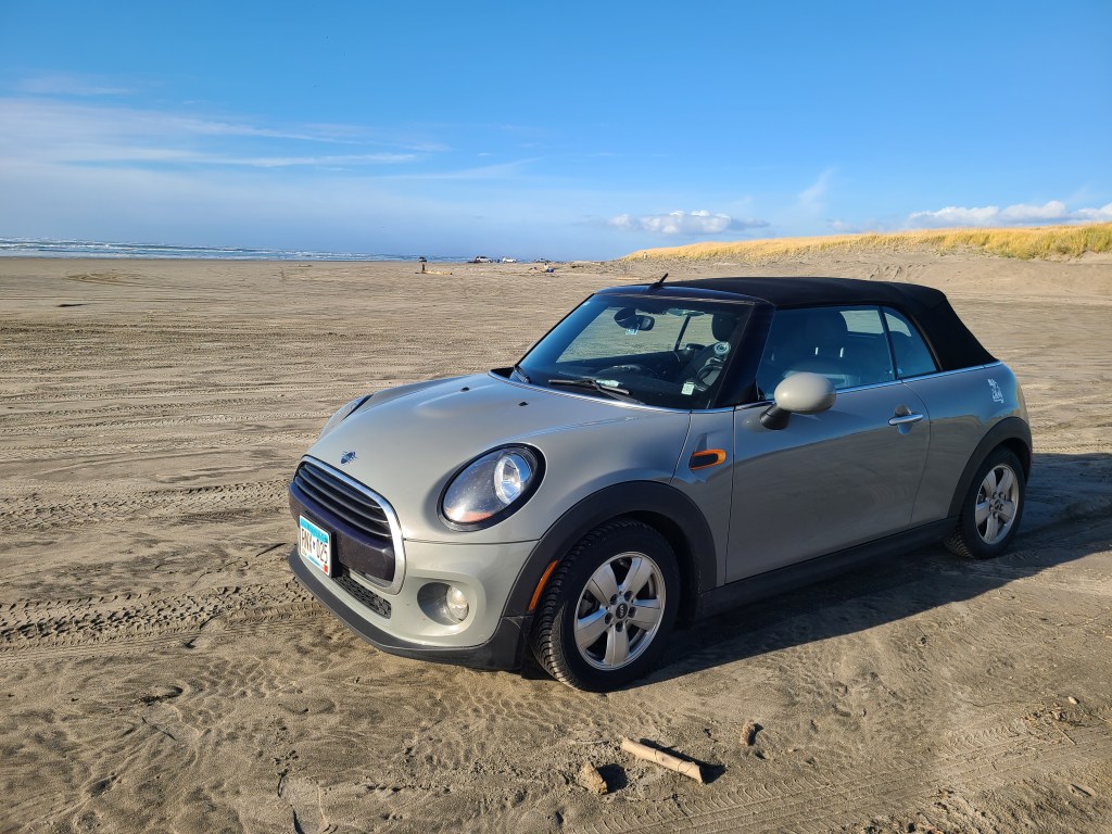
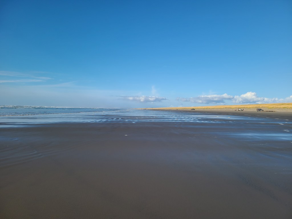
As I entered Astoria, I saw a sign indicating I was entering a tsunami danger zone. Nice! After checking into my hotel, I headed out to the closest beach on the Pacific side. After getting lost once I found the right road, and it took me straight to the beach. Like, directly to the beach. Car on the beach, I walked straight for the water. It was a bit big to get my feet wet, but I got to spend a while watching the waves. They were violent waves breaking over one another, though they we much smaller by the time they hit the beach. The waves came in over a 50 foot distance, in that some came short, and others came very far onto the beach. Took some pictures, headed back for dinner and relaxation. Not used to the time yet, so I’ve been surprised by how early it is all day.
Tomorrow is a zero day, so no driving and lots of resting. Now that I’ve gotten to the ocean, who knows where I’ll end up next..
Deets
License Plates: N/A
States: WA, OR
Departed: 7:48 am PST, 44 degrees
Original ETA 10:38am PST
Arrival: 1:13 pm PST
Weather: Ranged from foggy to sunny to raining
Budget: Food below, Hotel below
Food: Latte and Blueberry Muffin, Pork Tamales with rice
Music:Prince – Sign O the Times, Billy Joel – Glass Houses, Coldplay – Viva La Vida, Linkin Park – Meteora, Black Eyed Peas – Elephunk, Moon Ate the Dark – Moon Ate the Dark, Metallica – And Justice for All
Observations
I found a calm peace in the mountains
Going through fog banks it strikes me how dark it gets in there, and then you come out into the sun
Everyone goes the speed limit in Washington. And then I got passed by a couple cars going well over. They were both Oregon plates, heading to Portland. Like Minneapolis. Liberal cities drive fast.
Passing the lumber plants and it smells like Thunder Bay. Unpleasantly pleasant
I saw a small herd of elk last night going to dinner, which means I’ve seen more elk than bison on this trip
Pictures
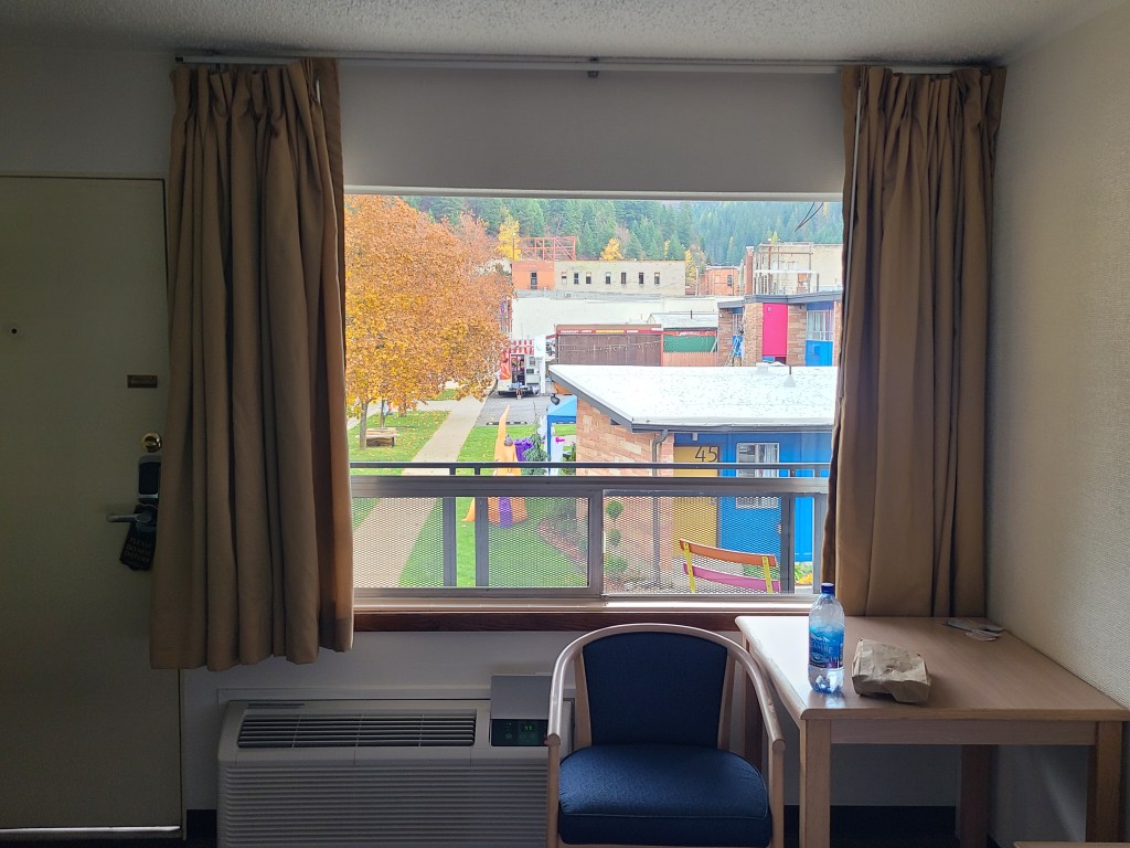
Sediment DamHofstadt Creek BridgeMount Saint HelensView from my hotel room
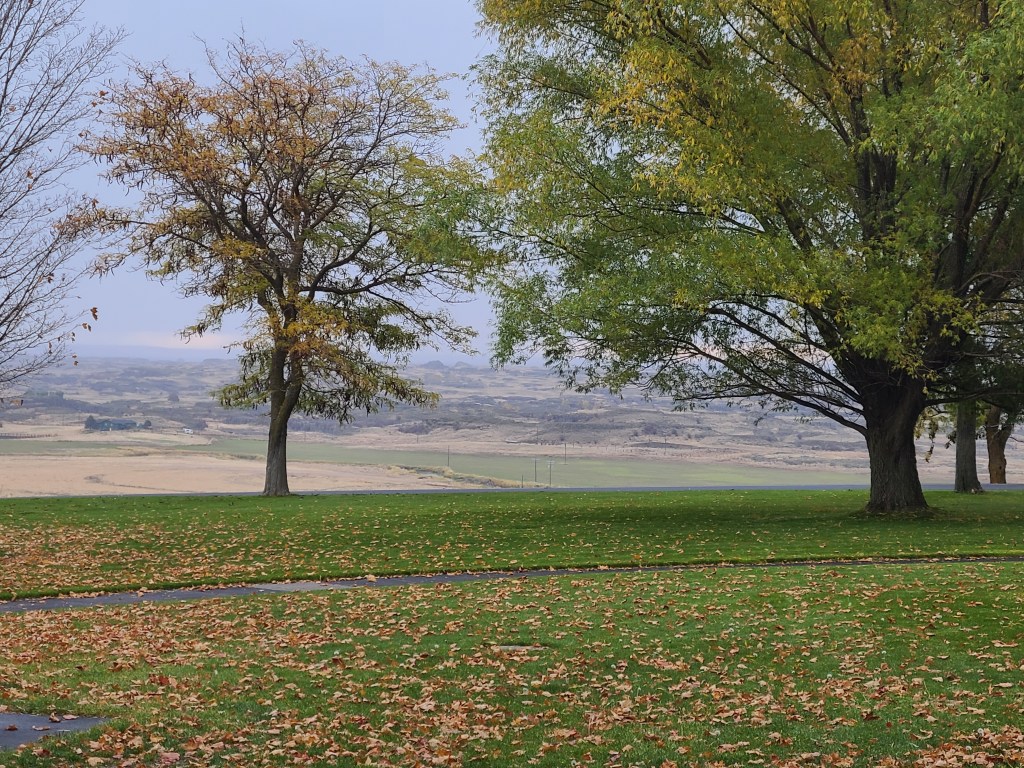
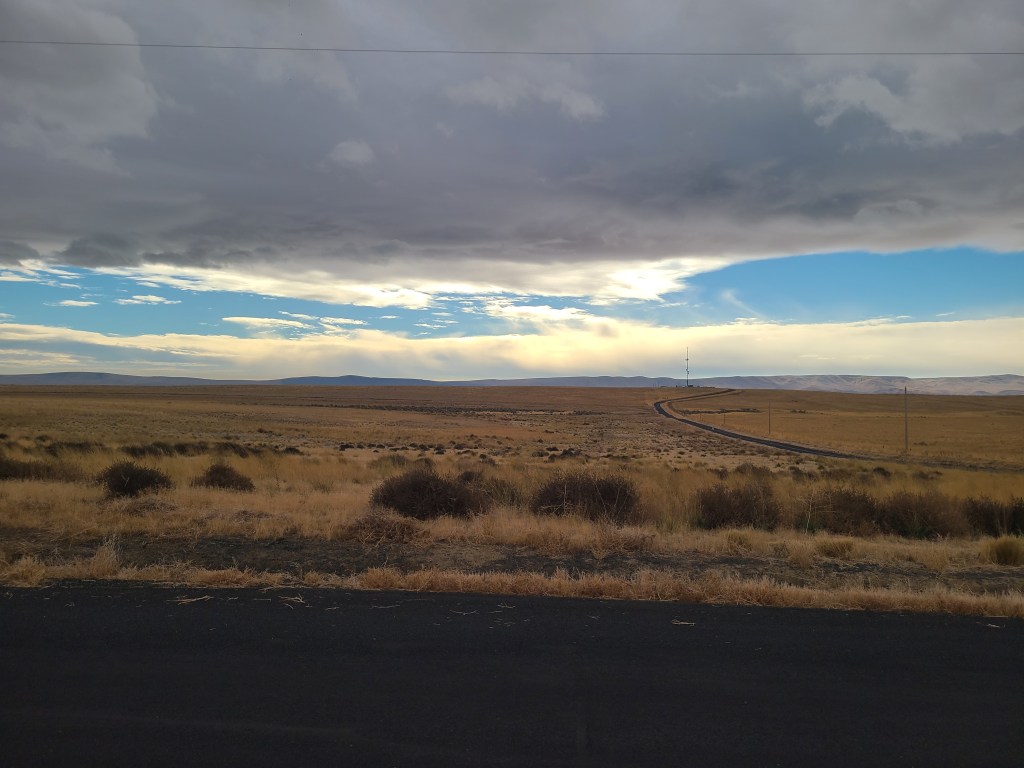
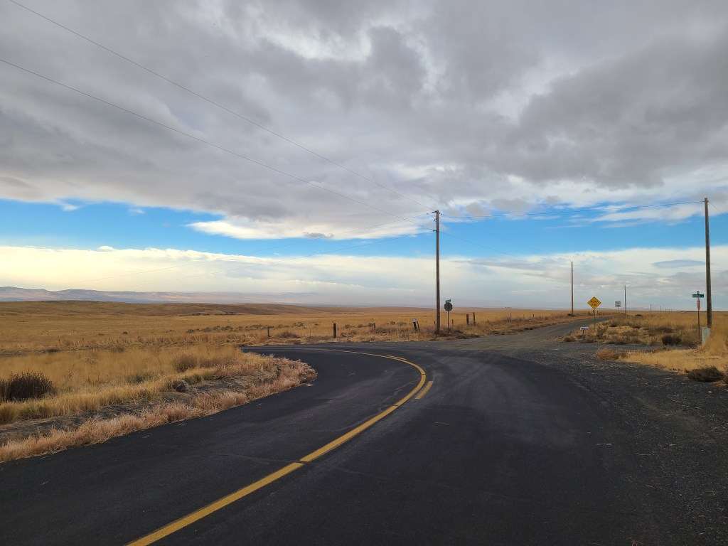
I came out of the Idaho mountains and crossed the great plains of Washington. It was like a mashup of everything I’d seen so far. Rolling hills (SD), but they’re covered in trees (WY). Significant hills (MT) and mountains (ID) in the distance, and lakes (MN) here and there.
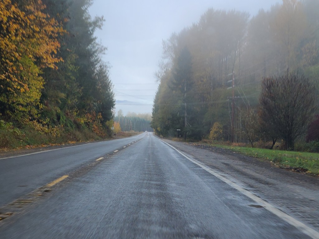
Coming out of Yakima I headed west on 12 into the White Pass. There was a sign listing that pass and another one, and the other was closed. Made my trip planning skills shudder to think how easily they close and less easily open. It had just rained, so the roads were wet. No problem there, except the spray. The car in front of you kicked it up unless you followed waaaay back, and oncoming traffic hit you with it as well. I made a risky pass overcoming an RV because it was like following a shower, and I wasn’t going to do that all the way over the pass.
Got to go through a mountain tunnel, which was cool. Just the one. And I’ve seen the whole “falling rocks” warning signs before, but never with rocks scattered across the roadway. Nothing bigger than a softball, but that still wouldn’t be a great thing to hit.
We followed the Tieton river for a long time, some nice curves here and there. I saw a Larch leaning out like it was perpendicular to the mountain, and noted the other trees were being very judgey. Also crossed the Continental Divide, but didn’t see the river change direction or anything. Also, did you know that if you trailer a boat across the Continental Divide, it has to be inspected ASAP on the other side?
Now for the fun part!
The Fun Part
I had been driving for many hours. While most of it was on cruise control, it was still a lot of driving. My right leg tends to get painfully tired at the end of the day. Unfortunately, that was exactly when the driving became much more active. As we rose above the river and the road stuck to the mountain, the curves became much sharper. So now I’m driving with my sad and tired leg, and it’s all getting much more complicated. No more cruise control. Also, it started raining.
Don’t let the movie fool you – it was huge and scary!
Coming around a curve and then curving back the other way, I had great visibility on a wall of rock and dirt. It was nice to have that view, so I could see the slide happen clearly, and in realtime accelerated. It was not a giant cliff landslide horrible thing. But it was rocks and dirt about the size of my car, and watching it slide down the hill at the car in front of me was a very constricting moment. They must have been terrified, as they were so much closer, but I was right behind them and instinctively ducked as I passed by. The slide was caught by a berm of rock squares put up for just this kind of thing, but enough of the rock made it to the road, and the dust still hung in the air. My bigger concern was that more of the mountain was about to come crashing down on me. Not to be.
That was very exciting, and I had no idea that “See a slide right up ahead of you” was on my life bucket list. Well, check that box! But it was intimidating. I don’t know about frightening, but a lot of thoughts went through my head in those 10 seconds or so. And it gave me a renewed respect for the situation you are in when going over mountain passes. Not just things falling on you. It wasn’t an old highway, but it wasn’t a new one. However, whenever you went over a particularly smooth section of blacktop, or a really ground up section, you were crossing over a place where there was a significant slide, and it took out the road. That’s scary enough, but there are so many of them. You don’t go far without seeing one. So now you worry about being crushed, or sliding off the mountain. I have one more serious pass in my future, and it’s recently been closed and re-opened. If it’s still open, I will approach that one with great respect. If it’s not, I’ll have to drive around that range and back up a bit. Oof.
Gravity Fails
Earlier in the day I had decided on an alternate route for the day, getting off the interstate onto the state highway. It was a nice change and didn’t add much time. That is, until I looked for interesting stops in the area. There was one that was quite a bit out of the way, but I realized if I skipped it I would regret it forever. It was a gravity defying hill! You might have heard of these. Put your car in neutral at the bottom of a hill and it was magically start to roll – uphill! I’m a big believer in the laws of nature, so I didn’t think this would actually be the case. But I wanted to try.
First of all, getting there was tricky. When I took the first turn I swear I heard my GPS say “What? Wait, What?” and then for a long time the argument (her side only) raged on demanding that I “make a U turn at the nearest safe location.” Except I wasn’t making any damn U turns. I was on a mission! The roads were one and a half lane blacktop and just kept getting smaller and smaller. Google maps told me the speed limit was 35, but there were no police within miles. I could see that far.
I finally arrived, passing the spot on google maps for the starting line, then slowly crawling along looking for the line. Worried all the way I’d been had, and there was no way to tell where to start. Also, there was a very sketch barn next to the road. This was all a ploy to lure in idiot tourists and take their stuff and then kill them. Finally found the line, turned around, and set up. Now, I had come down a bit of a hill from the barn. And I was watching to see if I’d be going down a hill from the start, but it all looked flat.
So I place the car into neutral, and it starts rolling. Not some tiny slow roll building into something more, but an actual “ha ha you think you’re going down a hill” roll. I looked to my side and it really looked like we were going uphill. And the hill down from the barn? Actually rolled up that hill. Gravity is a lie! About halfway up that hill I rolled to a halt. On my way back to the start again I stopped halfway and used the spirit level app on my phone to see how things leaned. It was almost perfectly flat, with a little bit nodding to being on a downhill. Getting back to the starting point felt even more so.
I break it down as being an almost imperceptible slope from the starting line, but enough that it gets you going. Then there was a clear flat area that your momentum would get you across, and finally you’d get halfway up the hill to the barn before Mother Gravity stepped in and spanked you with her wooden spoon.
The thing is, you really feel like the impossible is happening. It’s very convincing. Looking out the window looked like going uphill. That strong rolling start was enough to really surprise you and make you buy into the claim. If you ever get the chance, try one of these, it’s a lot of fun. Even if it’s all trickery.
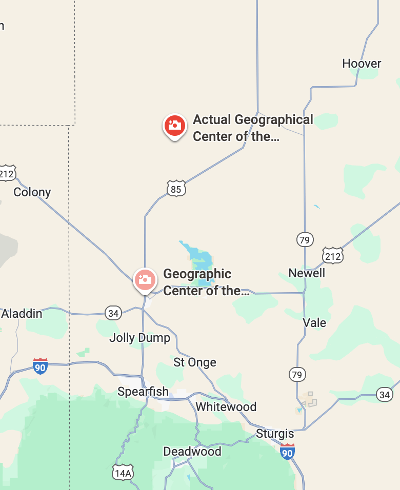
And that is what I call a proper quality side quest. Totally worth the two hours it added. Suck it, geographical center of the nation!
Dad is my copilot, or, Because sometimes you find yourself crying in a motel in Idaho, surrounded by mountains and fog, happy to be wandering the country with your father’s ghost.
I wrote about having this feeling that I had companions. Sometimes friends, sometimes family, sometime … who knows what? Well, this morning I was going to hit the road bright and early at 7:30, but didn’t make it til 8. Because I got this collection of super long texts from my sister. She had been thinking about me and my trip, and also thinking about November. We have lost more than our fair share of people (and a dog!) in November. All by coincidence, or possibly some sort of fate. One of those people was my Dad. Her thoughts on Dad as my companion (and some other thoughts) had me crying in that retro motel in the middle of the mountains, but it was happy and sad tears.
Dad and I have a lot in common. We can both spin a yarn, we enjoy Duluth in the rain more than a beautiful day, we play the same instrument, we love driving, we both had scooters, we both loved our kids more than we ever knew we could. And we loved road trips. When I was in high school we once drove around Lake Superior on a three day weekend. That trip is usually best done in a week. But we just tore through the miles, but still managed to stop and look at boats or eat a lunch on a picnic table in a wayside park. Even if I would have preferred that be McDonalds. I did most of the driving, as I was a newly licensed driver, but there wasn’t much left to learn. The car is an extension of myself. At one point my oldest daughter asked my wife if she could teach her how to make turns like me and her younger sister did. For some people it’s a flow state of instinct, for others it’s learned and not always loved. (Though to her credit her first trip of any substance was a drive halfway across the country in a questionable car and no money. She did just fine.)
We also wet to Duluth countless times, and it seemed to rain every single one of them. But that’s what Duluth really felt like to us, and it’s spread to other places too. So today I was driving through stereotypical Washington weather – 49 degrees just cold enough to need a couple layers of flannel but not cold enough for a coat, gray, drizzling enough that you need the wipers but not really enough to get you wet right away. Cloudy but with the occasional beam of sunlight shining right when you’re facing it and it blasts your vision. And it seemed so much like the weather Dad and I enjoyed not enjoying, and sure, lets just drive 350 miles in one day. That’s reasonable. And I don’t know if it was my sister who planted the idea, or that she clarified it in my mind, but Dad was around today on my drive, and man would he have loved it!
Deets
License Plates: UT, NV
States: ID, WA
Departed: 8:00 am PDT, 42 degrees
Original ETA 1:26pm PDT
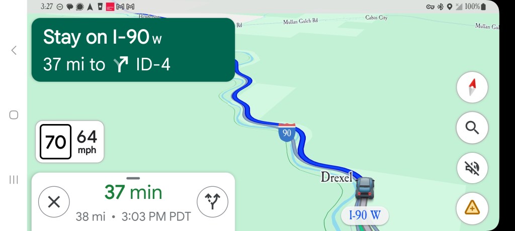
Arrival: 3:03 pm PDT
Longest distance between turns: 245 miles
Weather: Everything. Sun, drizzle, downpour, clouds, clear, windy, calm, 70 degrees, 20something degrees. Often a combo of many of those.
Budget: Food below, Hotel below
Food: “Double Dog” (won’t be doing that again), Caesar Salad (tired of burgers)
Music: Joy Division – Unknown Pleasures, PIL – Happy?, Fatboy Slim – Better living through chemistry, Best of Debussy, Lorde – Pure Heroine, Siouxsie and the Banshees – Through the Looking Glass
Observations
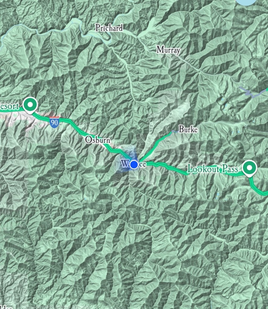
I loved Wallace, ID. It’s now on my top ten list of cities I’d love to live in.
As I left I stopped at the drive-thru (that’s all it is) at 1910 coffee in Wallace. Got a 24oz Latte and a large orange juice and the total was $7. Can’t believe it. Try that at Starbucks!
Saw seagulls. Sailors used to see seagulls as a sign of hope after countless days or weeks of nothing but ocean. I felt something similar.
More tumbleweed. Hit one with my car, didn’t do anything to the car. I did see one later that was big enough it would have caused some damage. Also saw a car with a large tumbleweed lodged in its grill. Looked like someone with some lettuce stuck in their teeth.
Crossed a bridge that had another airport-quality windsock on it.
I’ve seen so few Minnesota license plates, and only one other MINI this whole trip.
I see a lot of trucks with trailers with Indiana license plates. Is that a tax thing or just a crazy coincidence?
I passed a very large penitentiary, but there were no “do not pick up hitchhikers” signs. I guess they just think if the prisoner can escape that far, good luck!
There have been parts of Washington that are so windy it makes me wonder how they can tell if someone is swerving because they’re drunk or just being buffeted by the wind. And if you drove drunk in the wind, might they both cancel each other out and get you driving in a straight line?
Not to be obsessed, but Washington has had the least variety of license plates yet. Besides the odd Oregon or Idaho plate, it’s just all Washington. I went into a rest stop, which is usually great plate hunting ground, and they were all WA. All!
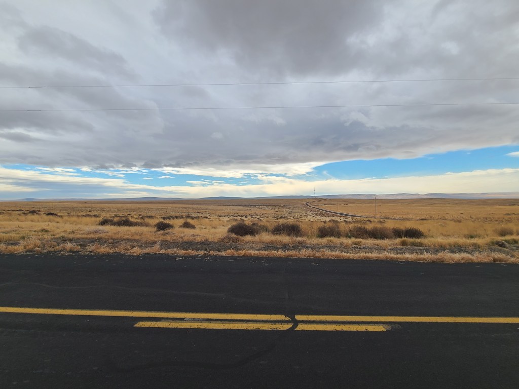
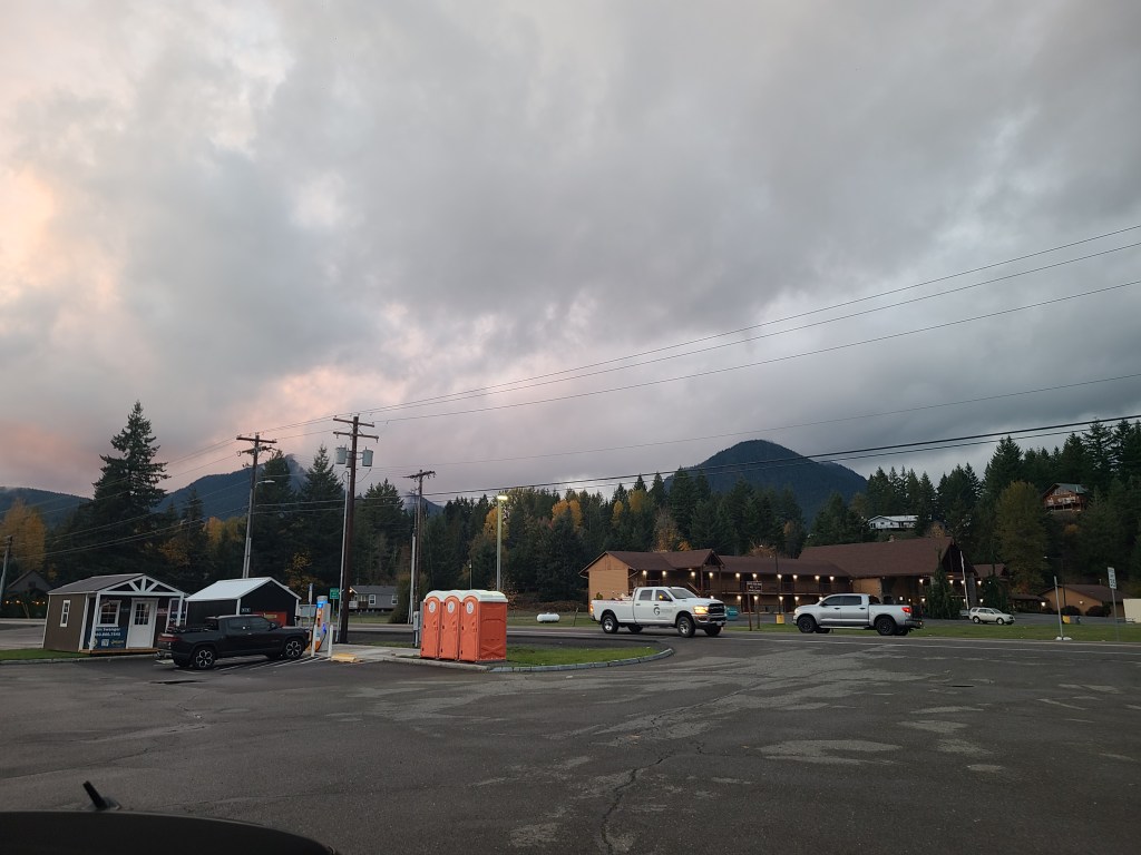
Pictures
Washington StateMiddle southern Washington State, wine country.Middle southern Washington State, wine country.The image doesn’t capture how enormous the sky wasA view through pickups of the lodge I’m staying in tonight. Not quite nestled in mountains, but still up in the hills.
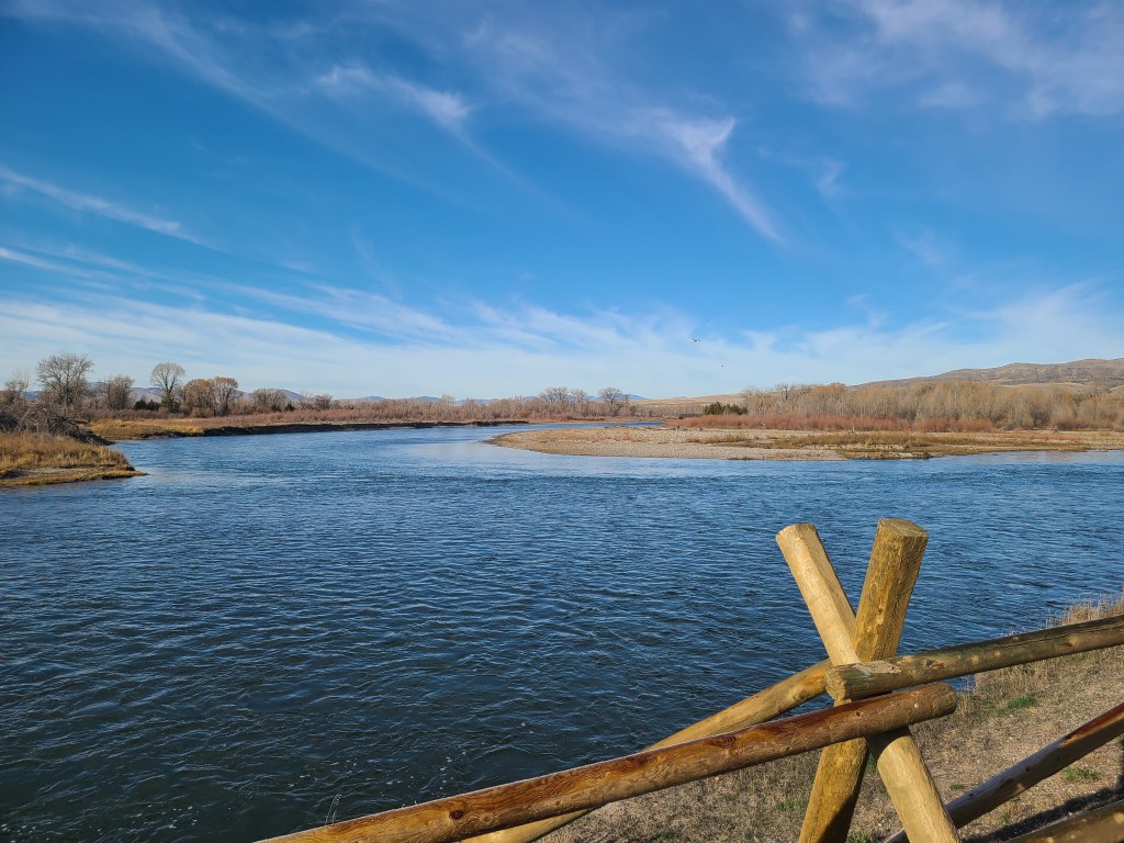
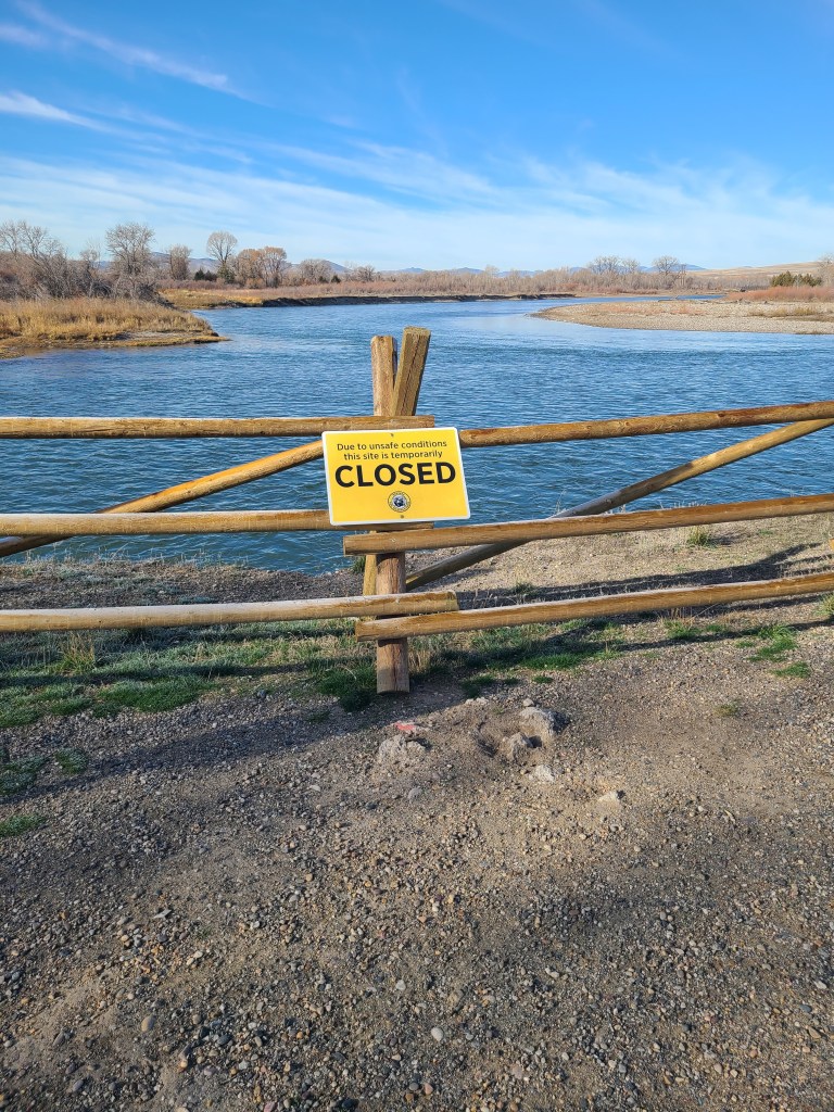
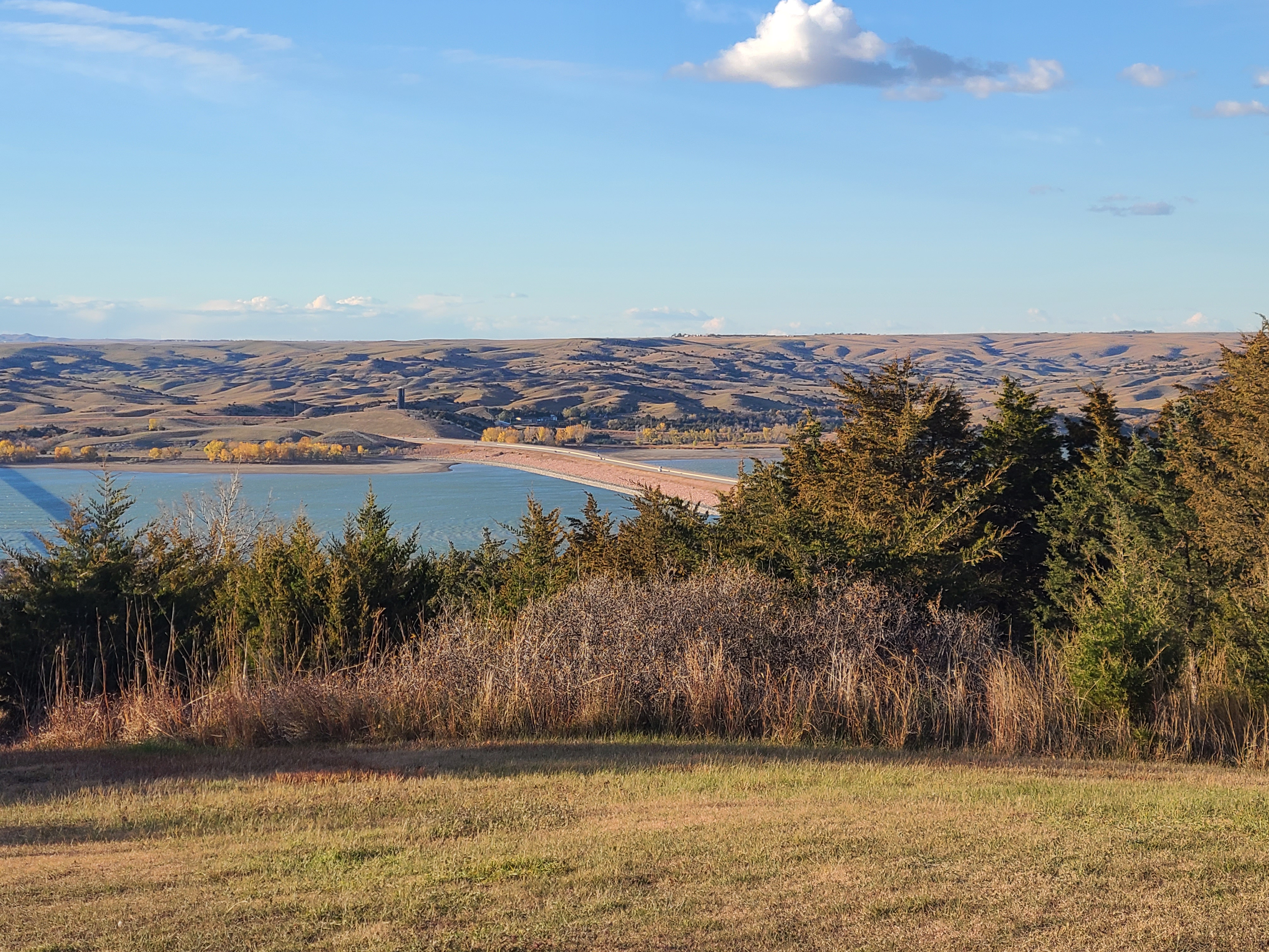
The only official stop today was at the headwaters of the Missouri river. I paid the fee online, which was handy since I didn’t have cash for an envelope. And now I am sure I’m going to receive emails about the joys of the Montana State Park system. The headwaters themselves were closed. Not the waters, obviously, but access to them. Not for the government shutdown, but due to “dangerous conditions” which seemed to have passed. Got to see the headwaters and it was.. two small rivers coming together. I’m sure there was a reason it was two rivers, but there was no documentation at the site. Disappointing. Score one more for the true source – the Mighty Mississippi!
Something I found odd about the park was the speed limit. In the park going from place to place it was 65 mph. If it were in Minnesota we’d have you putting along at 25. The frontage road leading to the park entrance was 70. Just didn’t feel right somehow.
There was one unofficial stop today, and that was Bozeman Montana. I have a friend who grew up there, so I took a picture from the car (including the car interior) of the high school entrance. And then I texted it to him with no explanation. I took a couple generic Bozeman pictures in case they had constructed a new school since he had graduated, but he texted back all sorts of confused. Worth it!
Mountains
I feel I’ve covered this topic enough, but had a few things to add based on today’s experience.
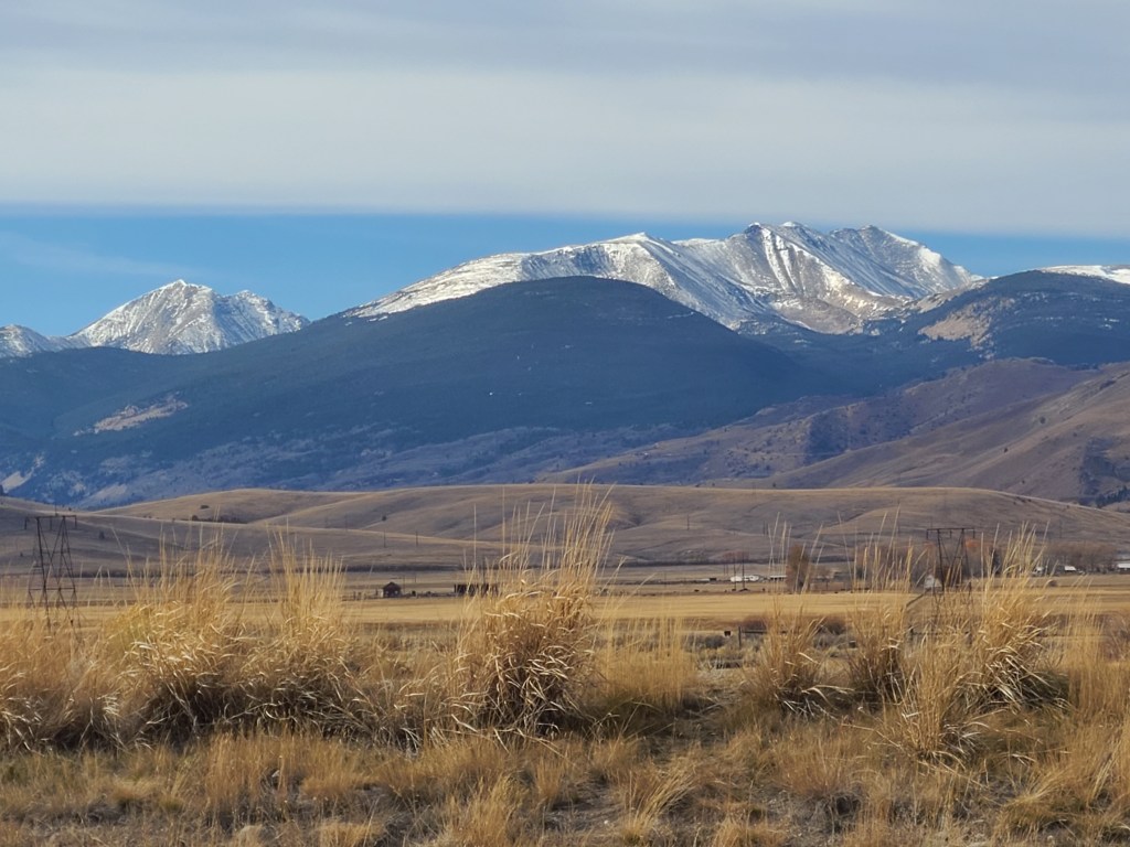
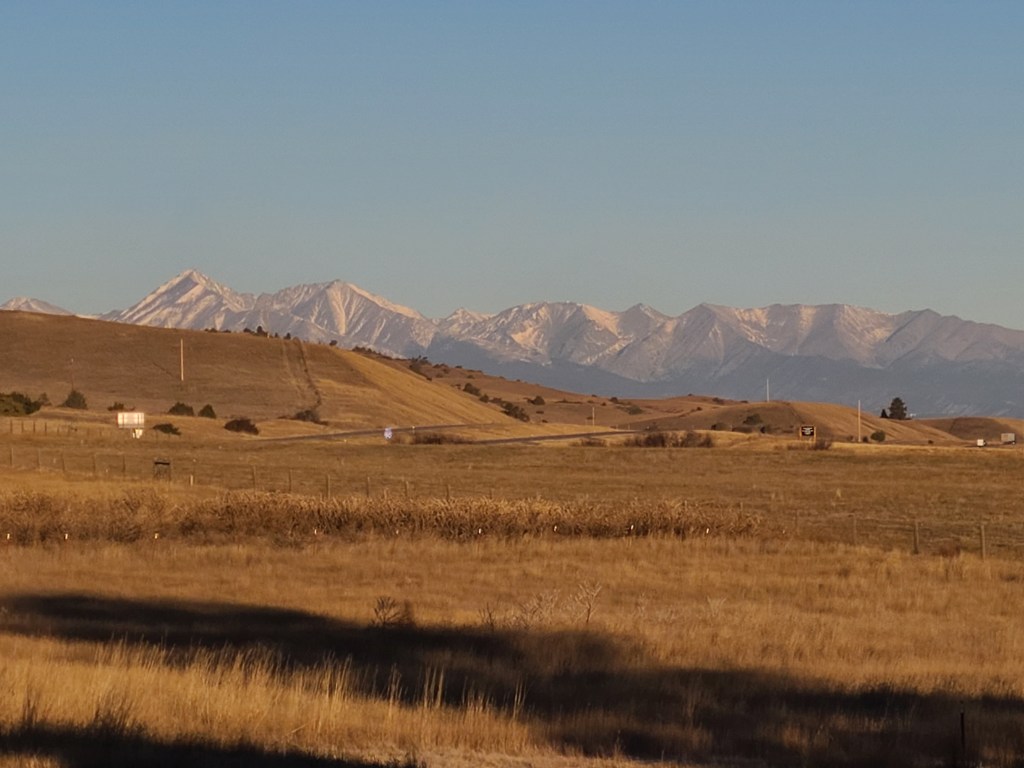
I expected it to be all mountains today but it was flat land with mountains sticking up here and there. Some had snow, some didn’t. It was fun thinking what it must be like up there, in the snow or in the dry areas, way up high. What a view, I’m sure. But so remote and peaceful. Clearly I need to watch Brokeback Mountain again. Not for the Brokeback, but for the Mountain.
While the flatland got smaller and the mountains closer, we turned a corner and it felt like I was seeing Scotland. The low rolling hills with a thousand hues of green and brown grass and the mountains large and cold looking in the distance. Beautiful.
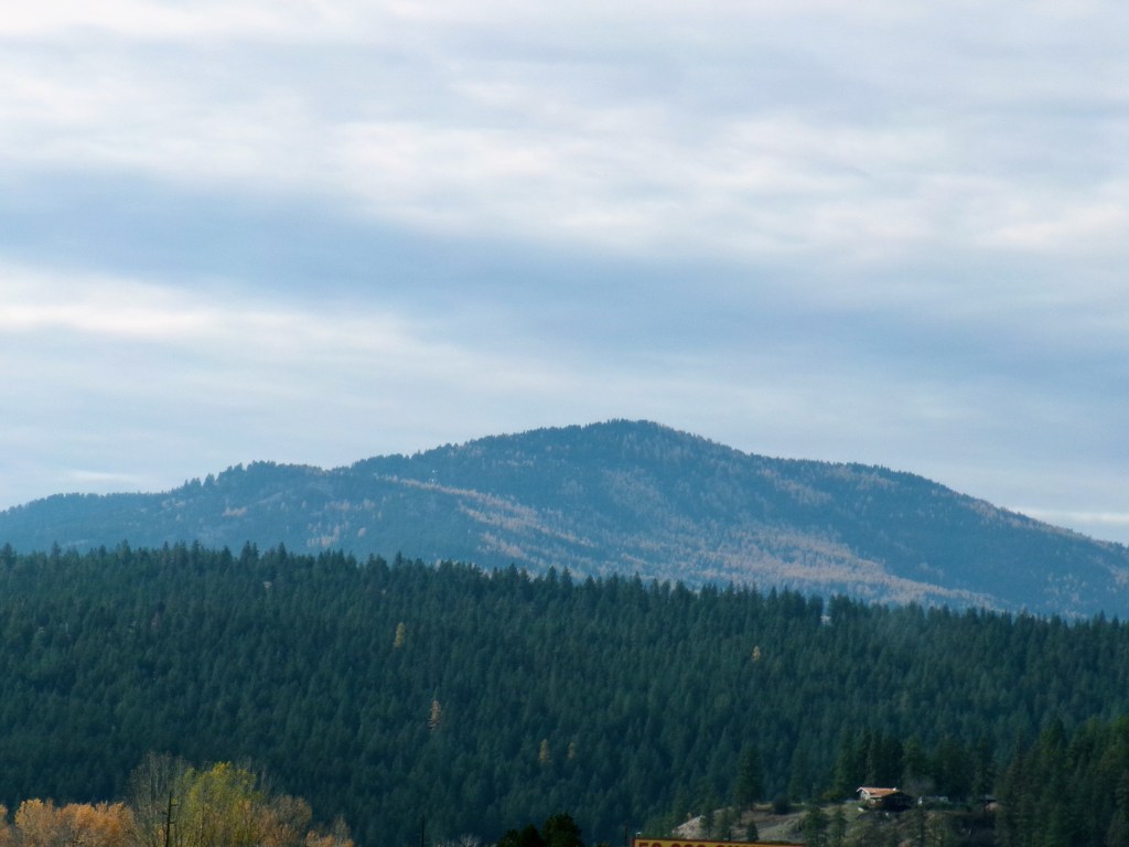
Telling stories
The dark fir trees were interlaced with what looked like yellow fir trees. After a bit of research, they’re apparently Larch trees, and lose their needles. But not after turning a beautiful yellow. The way they’re scattered in the hills, sometimes they’re a few sparse individuals. Other times they’re large sections of the mountain, giving them a mottled appearance. There was one particular mountain that had streaks of the yellow in their dark green.
Back when the kids were little, I loved making up stories for them. One favorite was the “King of Wisconsin” – back when there were kings and governors and burgermeisters and committees ruling over different parts of the country. Well, the king of Wisconsin was a loathsome dictator, and he had a wall built around the state to keep his subjects in. (I swear to got this was told long before 2016). Well, eventually the President decided everyone needed to be running things the same way, so it was fair and far less confusing. In doing so, some of the leaders were ousted from office. The King of Wisconsin was one of them. But the new governor ordered the wall to be turn down — with the exception that wherever there had been a heavily guarded gate, that wood was to be used to build big welcoming signs saying “Welcome to Wisconsin.” Not just to put forth the message of welcoming, but also to remember the tyrant who built the wall. And that is why the Welcome signs are made of wood – even today!
Again, seriously I came up with this story in 2006 or so. No political agenda or commentary. It was just a fun story to tell the kids. And I could stretch it out, you gotta believe. I would make that story go on and on and on for so long – and the kids loved it!
There’s a point coming here. And that’s the fact that I miss telling those stories to the kids.
And if I had kids in my car today… I would tell them all about the great Flaxton Firehose.
The Great Flaxton Firehose
Way back a long time ago, there was a town called Flaxton. This was so long ago it was even before the 1980’s. Before Television! Before Cars! So, a long unspecified time ago. Flaxton was a small mining town on the Flixton river. Total coincidence with the names. Flaxton was named for Eugene Flaxton, the inventor of socks. And Flixton was named for the kitchen took that you used to turn apples inside out.
The town was doing well. Some folks were mining by tunneling into the mountains. Others were panning for gold. Both were quite successful and all manner of equipment was brought into the town, and the engineers who knew how to use it.
In the spring of one of those long ago years, I forget which, there was a horrible fire on the mountain to the north. The town was spared, but the fire came close and everyone was very worried about future fires.
One of the engineers came up with an idea. A hose. A really big hose. One that was so powerful it could shoot massive amounts of water to far away places – like the side of the mountain. It used so much water they couldn’t just fill a tank and use the water from there. They had to put a really big hose in the river, and suck up the water from there. It was a clever system, because the water they shot up onto the mountain would run back down the mountain and back into the stream, so they wouldn’t dry up the Flixton river.
Wouldn’t you know it,a few months after the project was complete, a lightning strike ignited some underbrush and a huge forest fire was started. Everyone in Flaxton came out to help. They set up the hose and aimed it at the mountain. The engineer aimed the hose at the mountain, and shot a stream of water up on the mountain and it put out some of the fire! He aimed it carefully five or six more times and managed to hit enough of the fire that the conflagration was ended!
A young child ran up to the engineer and said the river was completely dry! The engineer explained about the water coming back, and just as he finished, small waterfalls appeared at the mountain’s base, sending the water back into the river.
Now, everything we back to normal, it seemed. Except the miners panning the river for gold just weren’t finding gold anymore. It was all gone. It was a hard winter for the panners, who had to join the miners in the mine. But when fall came around and the trees on the mountain started getting ready for winter, some of them changed color! There were hundreds of these trees, right where the water had been sprayed! The engineer climbed the mountain to see what had happened, and it turned out that when the needles fall of those trees that had been hit with water, there was gold on all of the branches!
The hose had sucked up the river water, but also the gold dust in the water. It stuck to the trees when the water went back down the mountain, and it wasn’t until those trees lost their needles that the gold showed itself.
For every mountain except the one by Flaxton, those were Larch trees, which turned yellow and dropped their needles. But in Flaxton it was gold!
Something like that. I miss telling those.
Wallace Idaho, a magical place
One of my thoughts today was about wanting to scare goats into fainting. And a complaint a day or two ago was the fact that the Geographic Center of the Nation was bogus. I did wonder about where the geographic center of the world was, but clearly I wasn’t thinking big enough. Also, I’ve been going on and on about mountains, and all I wanted was to be nestled in them. Surrounded and kept safe from storm and harm.
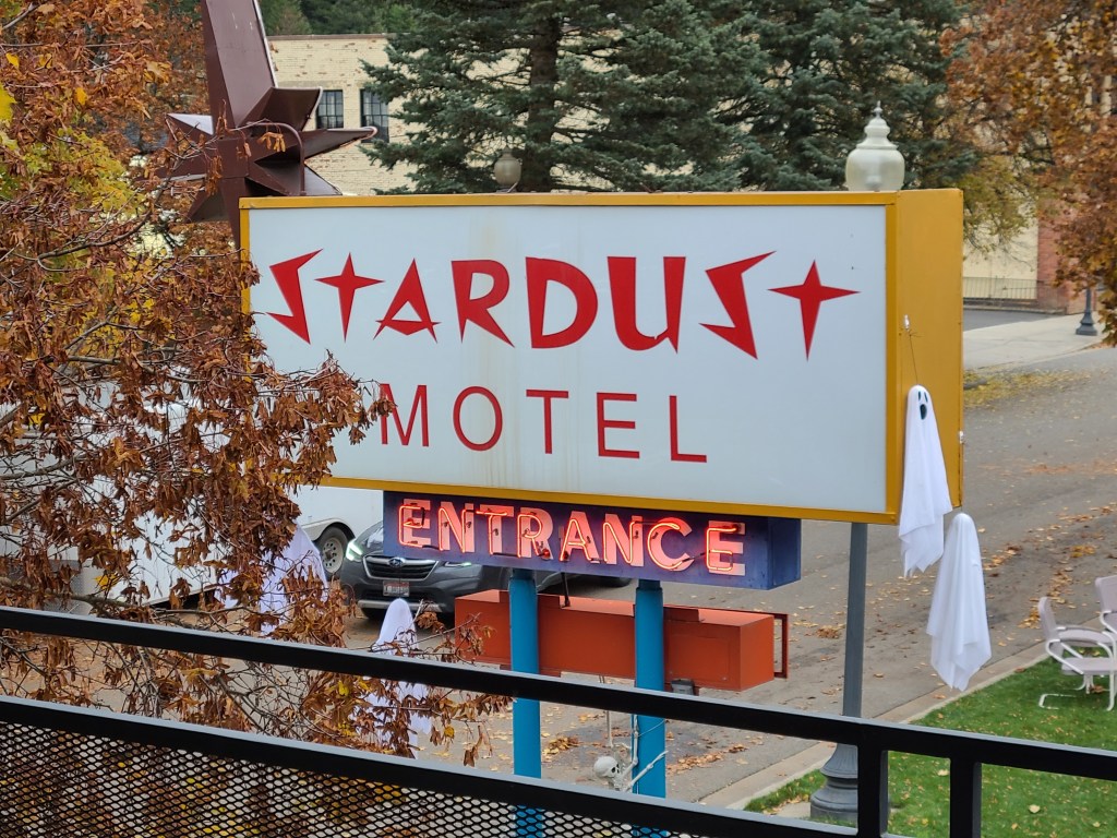
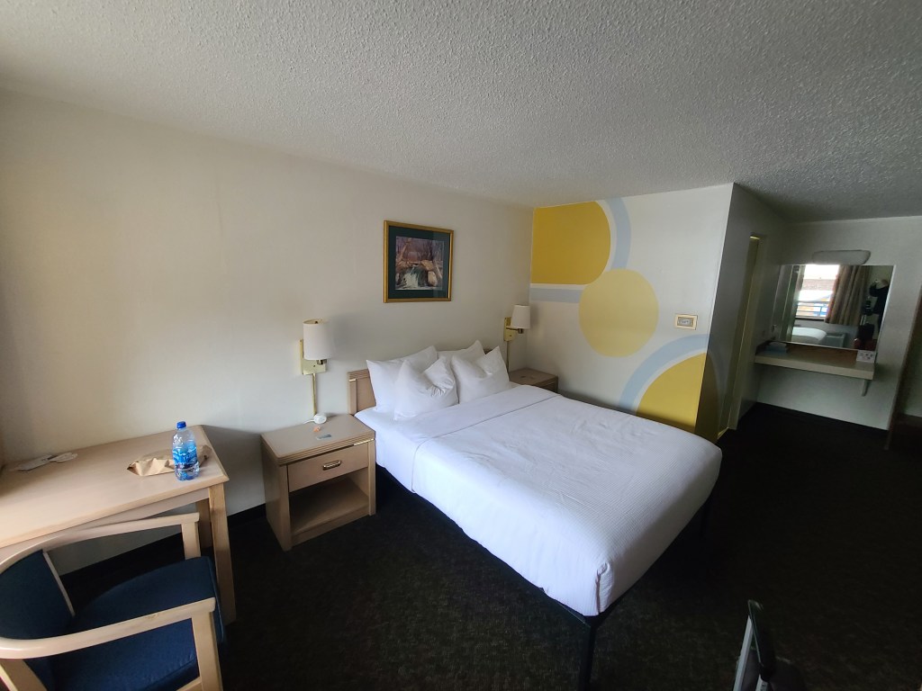
So the end of the day comes and I check into my amazing Stardust Motel in Wallace Idaho. I didn’t know it at the time, but now I knew it is truly a magical town. The motel is perfect. Supremely styled in a retro fashion, but comfortable and modern enough not to suck. They were having a Halloween thing in the parking lot next door. It looked like fun. And this little town is surrounded by really tall hillmountains!
After some debate about the worthiness of half a Subway from lunch, I decided to go out and get dinner. My research brought be two surprises.
First – Wallace Idaho is the center of the universe. Mayor decreed it. Got a picture of the sign and everything. So that’s the true and proper center of something.
Second – the restaurant I found for dinner? The fainting goat! That’s it! This might be my new favorite town!
I feel quite nestled.
Deets
License Plates: AL, AZ, CA, ID, KS, NC, SC, TN, WA, Quebec
States: MT, ID
Departed: 7:37 am MDT, 28 degrees
Original ETA 2:26pm MDT, but in PDT so 1:26pm
Arrival: 3:00 pm PDT
Weather: Massive blue skies turned cloudy, rainy after retiring to my room
Budget: Food below, Hotel below
Food: Latte, Latte, Grapefruitade (more in another post), Subway, Buffalo wings
Music: Bis – Return to Central, 07 – Simple Things, Massive attack – Heligoland, Thomas Dolby – The Flat Earth, Henryk Górecki – The Symphony No. 3, Op. 36, / the Symphony of Sorrowful Songs
Observations
The downside to not knowing what day it is – it makes “days of the week” pill boxes hard
At rest stop an old guy gave Rocinante the stinkeye. Jealous, to be sure.
That rest stop had individual restrooms – but they looked like a jail cell tho
Individual restrooms are better than standing next to some trucker farting
I keep seeing black billed magpies, very pretty – black and white sharply contrasting
There was a sign warning about wind gusts that had a for real airport grade windsock attached
A sign saying tire studs allowed through May 31 – doesn’t that jack up the road though?
I missed crossing 1,000 miles.
The longest distance between two navigational directions so far: 286 mi
Wrinkle in the 80 mph speed limit – in MT trucks are limited to 70 mph, so easy to pass. Very few elephant races.
Crossed the continental divide
Butte cut down a whole mountain copper mining.
Ate lunch at a lovely rest stop while looking at mountains
How frustrating must it be to be a trucker and have cars constantly passing you?
How many invisible cars have I accidentally run off the road?
Early in the day I saw a bunch of trees with fall colors, but I cant remember seeing any until now
When I see a crowd of goats I want to honk to see if they’ll faint.
Windshields block reality. I opened my window for a while and the view became so much more 3D and vivid.
MT has official roadside crosses.. They have a red metal post and a white cross. I saw one with a name, and another instance where there were three on the same post.
Furkot (nav software) knew I wanted my drive to be 9am-3pm. But it figured in the time change. So instead of 6 hours I got 7. I didn’t want more! Although when I’m going west to east it’ll be the opposite.
I feel like I’m with someone. “When we get to the hotel” or “Where are we going for dinner.” Sometimes my companion isn’t anyone in particular, other times it’s a friend or family member. It’s nice to feel that.
Why do trees grow straight up, and not perpendicular to the surface?
Pictures
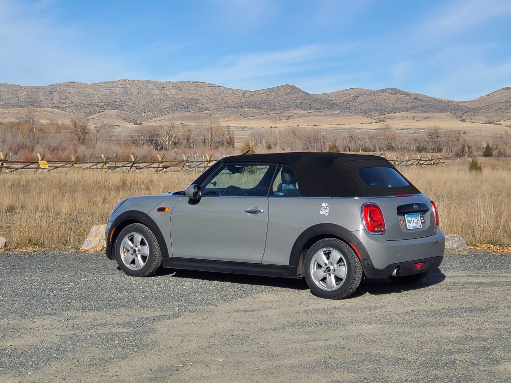
It’s the mountain above Flaxton – can you see the streaks?On the left there – those look like Tetons to me, but I know the grand ones are nowhere near hereTwisties! Exactly what we want to see!She’s so cute! I’m sure that’s how the truckers refer to her as we whip on by..Yup. There it is. Missouri. Beginning.This is Wallace, finely nestled
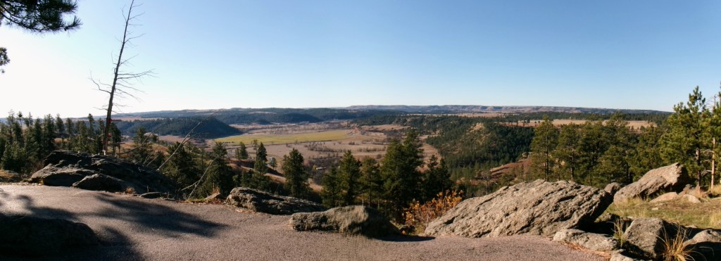
In order to cut across Montana on some more interesting roads, I had to go north a bit. When I realized I had to go northeast for a while, it made me worry for a moment that I was disrespecting “go west until I find an ocean” but honestly, that’s just silly. But I thought it, and it seemed like a fun title. The drive today was less exciting than previous days. First of all, the highlight was Custer’s National Monument, but it was closed. Payback for the free admission to Badlands and Devil’s Tower. It was a lot of driving through the rolling hills. Remember when I talked about thinking the mountains would just be flatlands and then mountains, like a wall? I’m thinking that may actually be the case.
I went over passes that required chains for trucks in the winter, and had pulloffs for putting them on and taking them off. There are passing lanes for trucks lumbering up the hill. They go up up up and then down down down but don’t really look like a mountain. So were they? Really want to know I drove over a mountain. Tomorrow I will go over a 6,000 foot pass, so I’m guessing that’s my chance.
I’ve been seeing these dark blue hilly or mountainous shapes on the horizon. Extremely Significant Hills. Finally near the end of the day I saw one with considerable snow cover. I’m calling that a mountain! Looking at the map that could have been moderately close, or Wyoming.
There is so much exposed geology here, it’s deafening. If we had one of these rock outcroppings or a cliff, even just 20 feet high, we would have named it, built a state park around it, and turned it into a state symbol. In Montana that’s just called land. Something about taking for granted the things you have around.
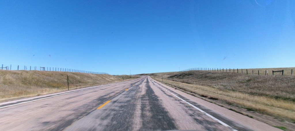
As excited as I am for the mountains, it’s hard not to be awed by these vast plains. They go on and on and on right to the horizon where those blue hills show up like they’re something in a video game you haven’t unlocked yet.
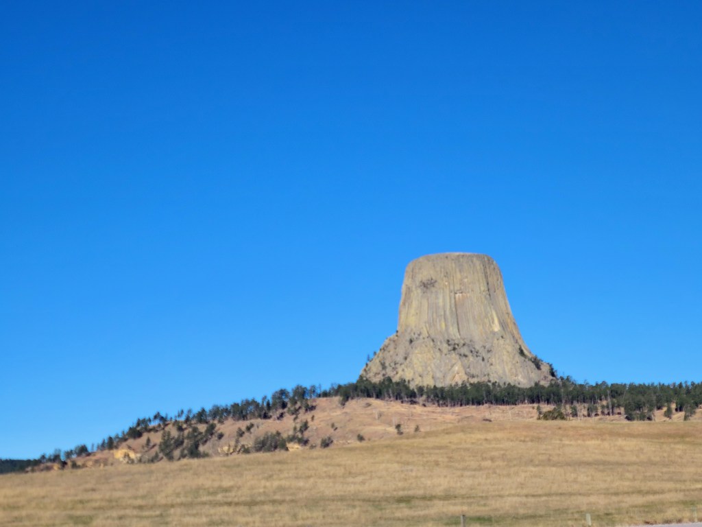
As I cross these prairies I can’t help but think of people in Model T’s crossing the land a hundred years ago. Or the pioneers walking next to a covered wagon watching out for prairie dog holes so nobody (or horse) breaks a leg. And the Native Americans crossing the land, or just being in the middle of that sea of earthen waves. I feel like that would be less lonely and overwhelmed and more about being impressed and respectful of the land. Seeing the Devil’s Tower rise out of nothing, just a chunk of land had to be awe inspiring. In any of those cases, it’s so easy to think of the hardships they faced. And who is going to look back on us? What are our hardships?
It was a long and repetitive day, but I was entranced by those hills. But seeing a set of hills with a forest newly burnt, I was impressed by nature’s resiliency. But that moment, without a picture or a note about it, would likely be forgotten. Obviously in this case I created a note to remember the idea. But so many of those moments or beauty show up and disappear so fast, and they are fleeting in my mind as well. So I’m working hard to enjoy them, but really enjoy them. Take them in as hard as I can, and appreciate them. More mindfulness, it seems.
Tomorrow: Headwaters of the Missouri, Bozeman to take a picture of the high school and send it out of context to a friend who grew up there, and Idaho. And mountains?
Hey not to be that guy, but there is a way to subscribe to these posts, so when a new one shows up you get an email or whatever.. It’s not a number I’m trying to build or anything, just offering something that makes it easier to follow new stuff. And thanks for reading! I write this for me, but also for you.
Deets
License Plates: ND, Ontario
States: WY, MT
Departed: 8:56 am MDT, 32 degrees, Massive blue skies
Original ETA 2:00 MDT
Arrival: 5:00pm MDT
Weather: Bitter cold in morning with wind, warmed up to 56, Big Sky country indeed. All blue
Budget: Gas TBD, Food below, Hotel below
Food: breakfast latte but the lid wouldn’t stay on, lunch missed, dinner was a particular fast food I won’t see again for many states
Music: Classic Rock playlist, Dire Straits – Brothers in arms, then just a queue based on that.
Snippets
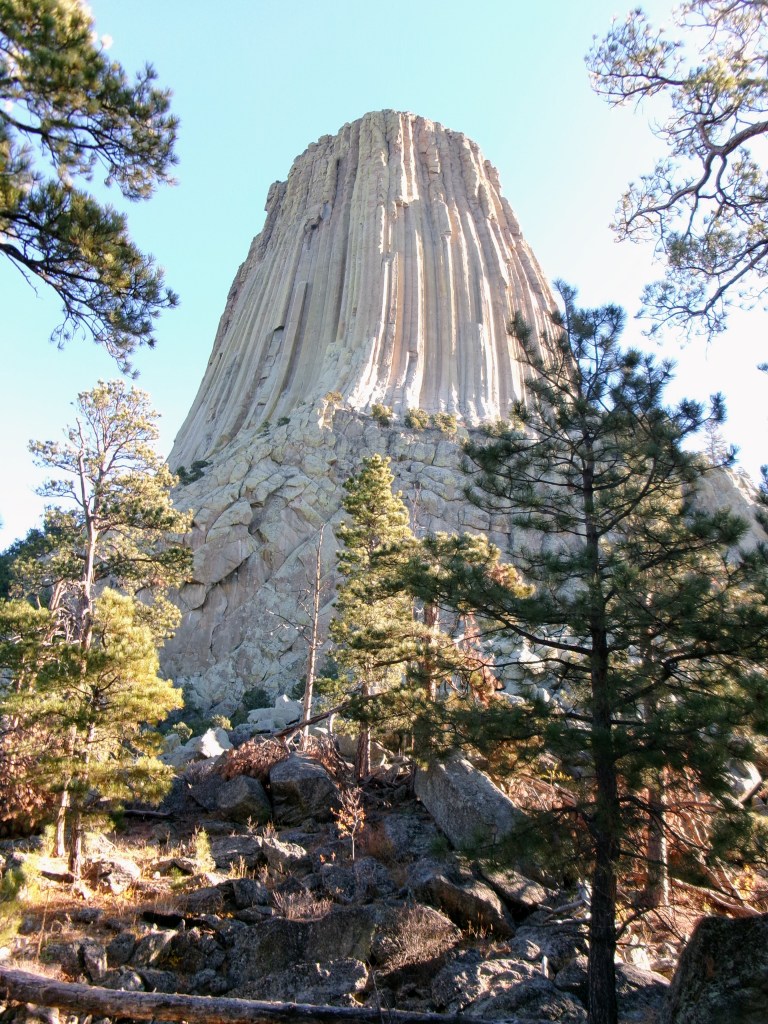
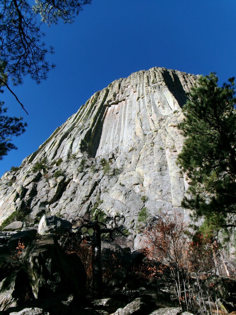
It was 32 and windy at Devil’s Tower and two climbers were heading up to climb. No idea how they’re going to do that.
Hey! It’s Rocinante’s (my car) birthday!
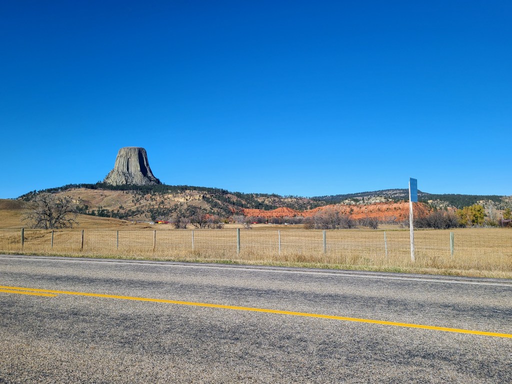
Devil’s tower was as impressive as I thought it would be. More humbling geology
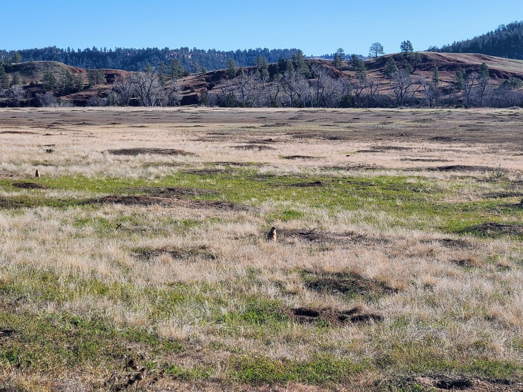
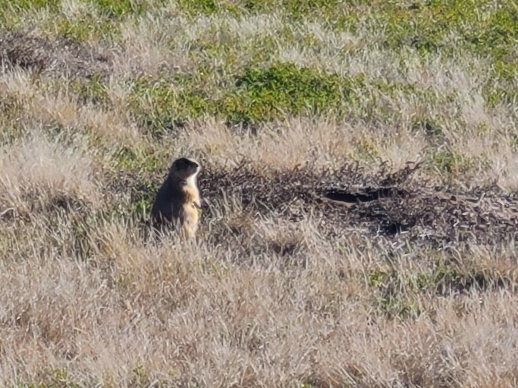
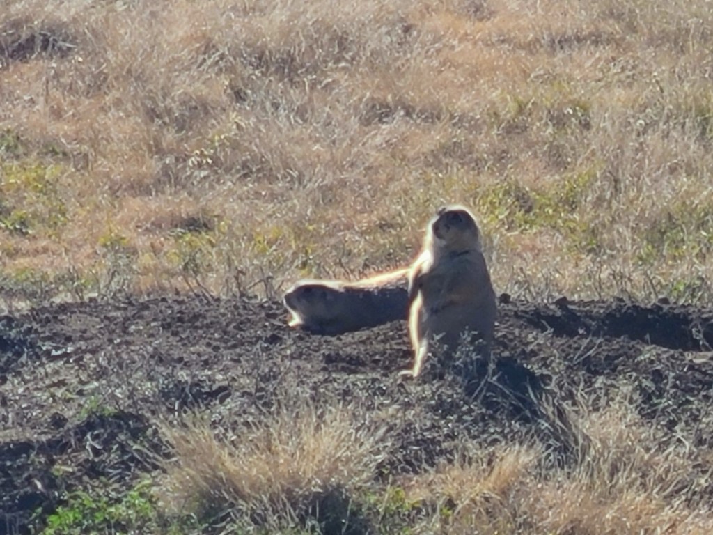
At the base of the tower is a prairie dog village and it was immense. Also, they chirp
A large bird flew over the prairie dog village, or rather the very large bird feeding ground
For as much as I bitched about Bison in South Dakota, there were none in WY, so yeah
Montana had something called “Roadside tables” that appeared to be a wayside, but with.. tables?
Custer’s battlefield was closed due to shutdown, road entrance and all
Stopped in Hardin for a Latte and Therapy sitting in my car at Custer city park. I feel like I was being trolled by the police. They passed by a lot of times.
Another tumbleweed
Have not seen (any?) motorcycles, even around Sturgis.
Have not seen much political stuff anywhere
Pictures
Devil’s TowerDevil’s TowerMajesticIt just pops up out of nowhereMuch of my dayA huge prairie dog villageThey chirp. A lot.
It was a day. Short drive, but long in interesting stuff. I woke up seriously early and thought I could just get on with it and have time at the end of the day. Which was great, as I needed the afternoon nap more than I needed a snooze bar in the morning. Tomorrow I have some weird timing getting to Devil’s Tower and getting to the gift shop when it opens. But in the end I’ll be in Billings. Maybe I’ll check out the pictograph caves.
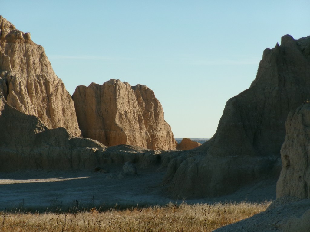
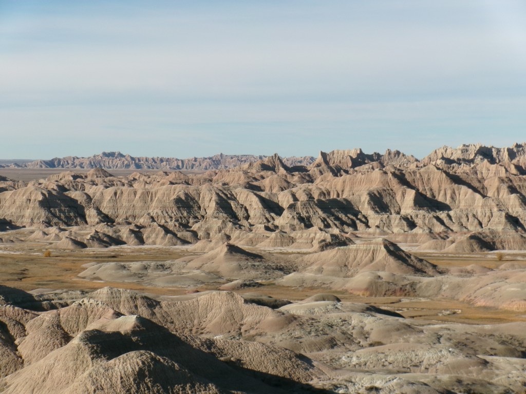
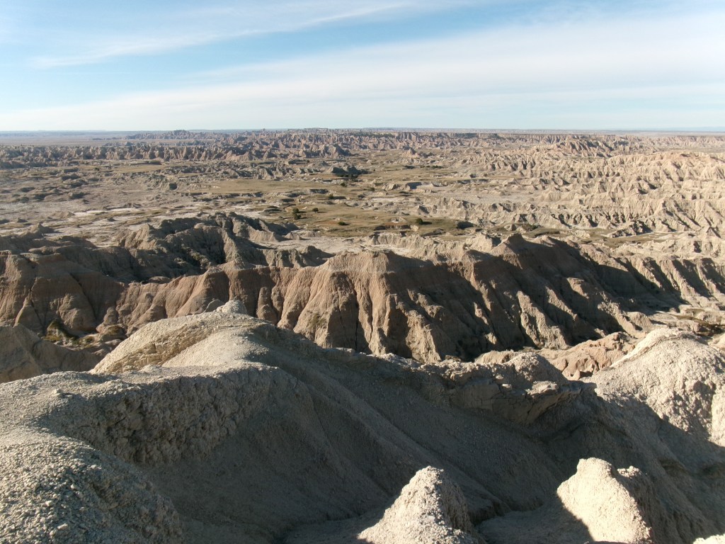
Badlands
I thought the day looked boring, so in looking for diversions I noticed a badlands loop that looked twisty and not too far off the original path. Turns out it was a National Park, so it was free – though all the buildings were closed, and I counted only one ranger in the whole park. He was manning a speedtrap. The lack of visitors meant I saw few cars, and at no point was I following a lumbering RV down a twisty road, cursing their existence. Today, I merely drank in the curves and enjoyed the drive and the views. I have a note that “sometimes twisties don’t mean fast” and I think it means curvy roads are fun to go stupid fast on – but really only when you’re in the movies.
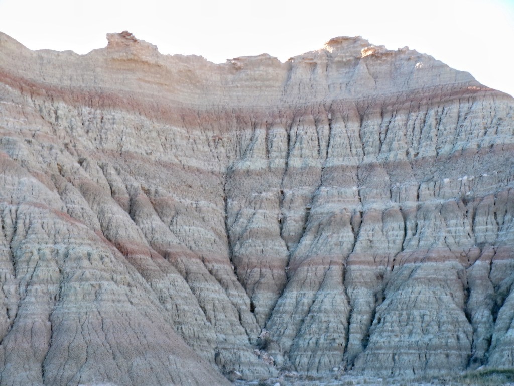
Another note: “The badlands are so quiet and peaceful and beautiful they make me want to throw up. And not in a bad way.” It was a strange thought following an even stranger feeling. It was just overwhelming enough that I wanted to express my happiness in a way without words or actions. Don’t worry, I didn’t hurl. But I was struck by the quiet. I even recorded some of it. It sounds like absolutely nothing. No highway buzz, no running engine, not even birds or bugs. Just vibrant silence. I think I appreciated not only the silence, but the age. Those rocks have been blowing up and eroding and wearing down and dusting for so very long. They don’t care about you or me or politicians or Netflix original series. They don’t care about anything. They’re just there and they will be there long after we’re gone, no matter how that happens.
My dad would go on and on about glaciers and moraine and ancient lakes. We would groan and try and tune him out. Of course I wish I had paid more attention, but no teen would have. I can’t remember hearing him talk about the badlands but I really wish I had the opportunity to go there with him. I would listen to every. single. word.
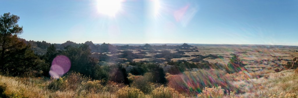
Geography
Flat on a map does not do bumpy in real life justice. I didn’t have any assumptions about when I would see mountains, for some reason I thought I would drive across the flat prairie and there they would be. Walls of mountains from one end to the other. Driving into them would be like entering MIrkwood. You would go from one to the other and that’s it.
Apparently that’s not how it happens. Granted, I haven’t seen mountains yet, but I think it’s going to be interesting and surprising in its lack of being surprising, if that makes sense. In Rapid City there were really big hills in the distance, but they didn’t look like mountains. Over the course of the day I would be driving past rolling hills, then moonscape like badlands, more hills that made me wonder about mountains, and then when I cross the border into Wyoming something happened. They were still hills around me. The kind of thing that farmer could walk to the top of and have a nice view. But they got bigger and closer. More frequent. And then less convincing that you could just walk to the top of them. (I have this thing where I want to climb to the top of every hill I see, though I seldom do. Just to see what you could see.)
So I am quite excited for tomorrow and beyond.
The bullshit geographic center of the U.S.
What the actual fuck. So, no it’s not what you think. It’s not the center of the lower 48. It’s the center of the nation. Meaning it includes Hawaii and Alaska. Or.. wait.. no? Now I’m reading on the page on wikipedia that it might have something to do with demographic information?
At the very least, we know that Lebanon Kansas is the center of the lower 48. I can buy that, looks about right. If you add Alaska to the equation it seems like it should be a lot further north than South Dakota. And Hawaii? That’s my main issue. We measure the middle of the space that includes all 50 states. But Hawaii is a quarter of the planet away. How does that stretch to South Dakota?
Ok, fine, maybe I’m a moron. Maybe this is the right place. All of the signs that led me to this monument (and there were many) got me to this town in the middle of nowhere. I was so excited to stand on the marker on the ground (like the 4 corners in the SE US) and say I was in the middle of it all. SO exciting. So when I get there and find out the ACTUAL point it a twenty miles north, likely on private land, I just about lost my shit! Frankly that’s false advertising, and bogus and irresponsible.
Food: breakfast latte great, lunch gyro delicious, dinner Reuben fair (coleslaw was so sour it tasted carbonated.) Fries were decent though.
Music: Radiohead – Kid Amnesia, Crystal Method – Tweekend, Crystal Method – The Trip Home (I see what I did there), and I switched to radio near the end of the day, just for variety. In the badlands I went with silence, as it seemed appropriate
Snippets
This is not the shoulder season, it’s more like the armpit season. Between the shutdown closing National places, and the off-season November month, I’m strolling through places uncrowded and driving unblocked by RVs. Bliss
It still awes me when I see the gates on the interstate, and the signs talking about the road being closed in inclement weather. They’re everywhere out here.
There’s a crop that looks like something half the height corn, tan on the bottom and maroon or brown on top. Looked it up, it’s sorghum. And there’s lots of it in South Dakota
I’m going the speed limit and I’m the fastest car on the road. I’m even using google maps to GPS my speed. Is it just that everyone here obeys the speed limit? And by here I mean everywhere but Minnesota?
Saw my first tumbleweed! It tumbled across the highway in front of me.
There has been a lot of construction-like activity. Speed will drop from 80 to 65, down to one lane, maybe see some construction vehicles, then eventually it goes back to 80 and two lanes. I think I’ve done that exercise a dozen times by now.
Wall Drug
Of course I went there.
I needed two very common personal items one would get at a drug store. They didn’t have either. I had to go to Target. Everybody at Wall Drug seemed nice, no crowds, no wait for purchase, mostly just empty.
Somewhere in there we switched to the Mountain time zone.
In Wyoming the signs announcing a nearby historical marker have the title of the marker listed below. So you know if it’s something you want to see or something about a vice president 50 years ago.
I really wanted to see some bison. I finally saw three or four in South Dakota, but that was it. I saw more deer in Wyoming than bison in South Dakota.
Reasons to visit our tourist trap
As seen on American Pickers
As seen on Pawn Stars
As seen on the Discovery Channel
As seen on Star Trek
Rachel Ray loves us!
Written up in New York Times
As told by the New York Times
Dances with Wolves movie props
Dances with wolves (again)
Dances with Wolves movie set
Custer battlefield artifacts
Original General Lee car
Amusing billboards
Mexican food so good Trump would build a wall around it
Exercise makes you look better naked. So does tequila
In wine there is Wisdom. In water there is bacteria.
We’re like a cult but with better kool-aid
Pictures
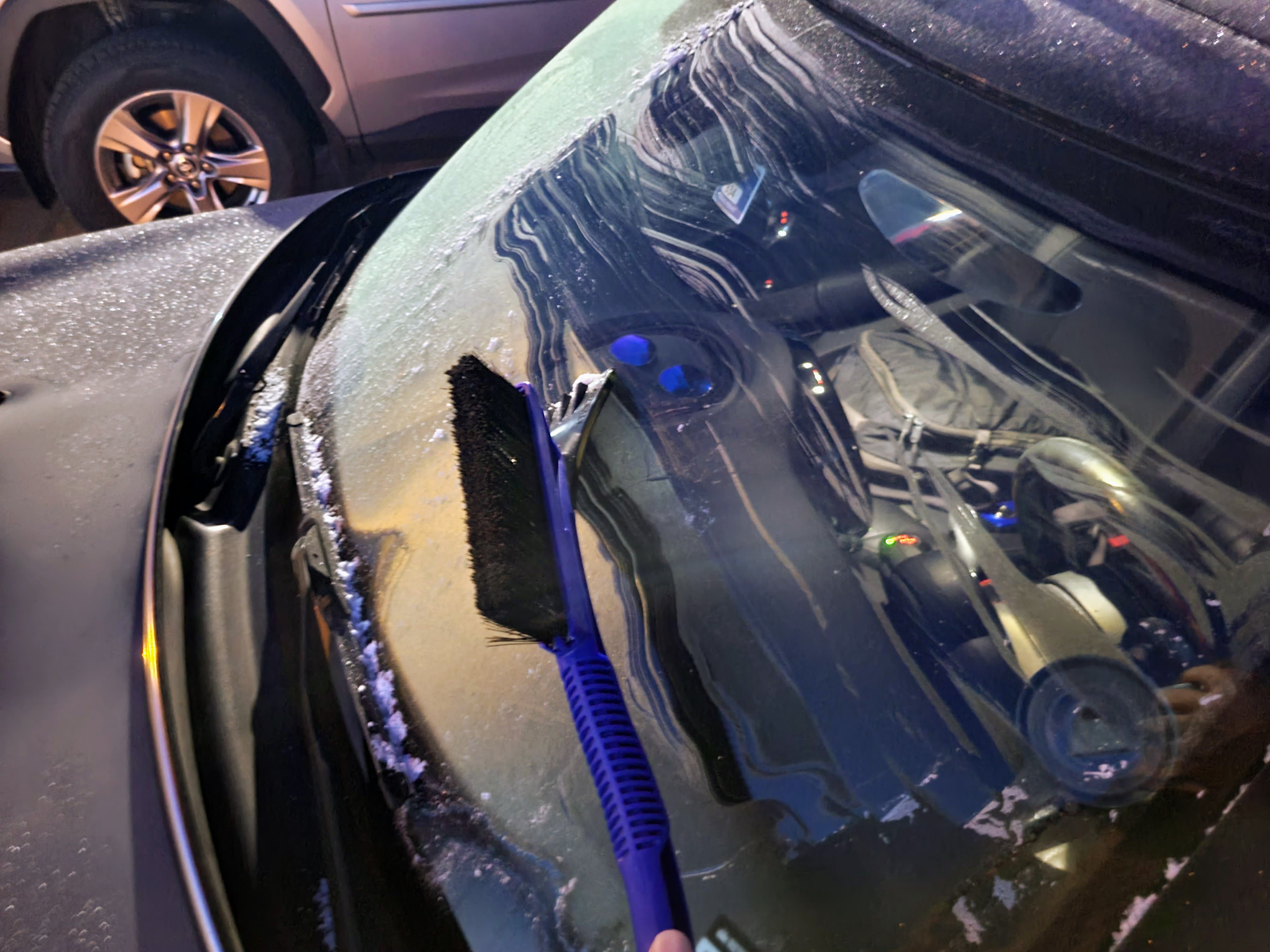
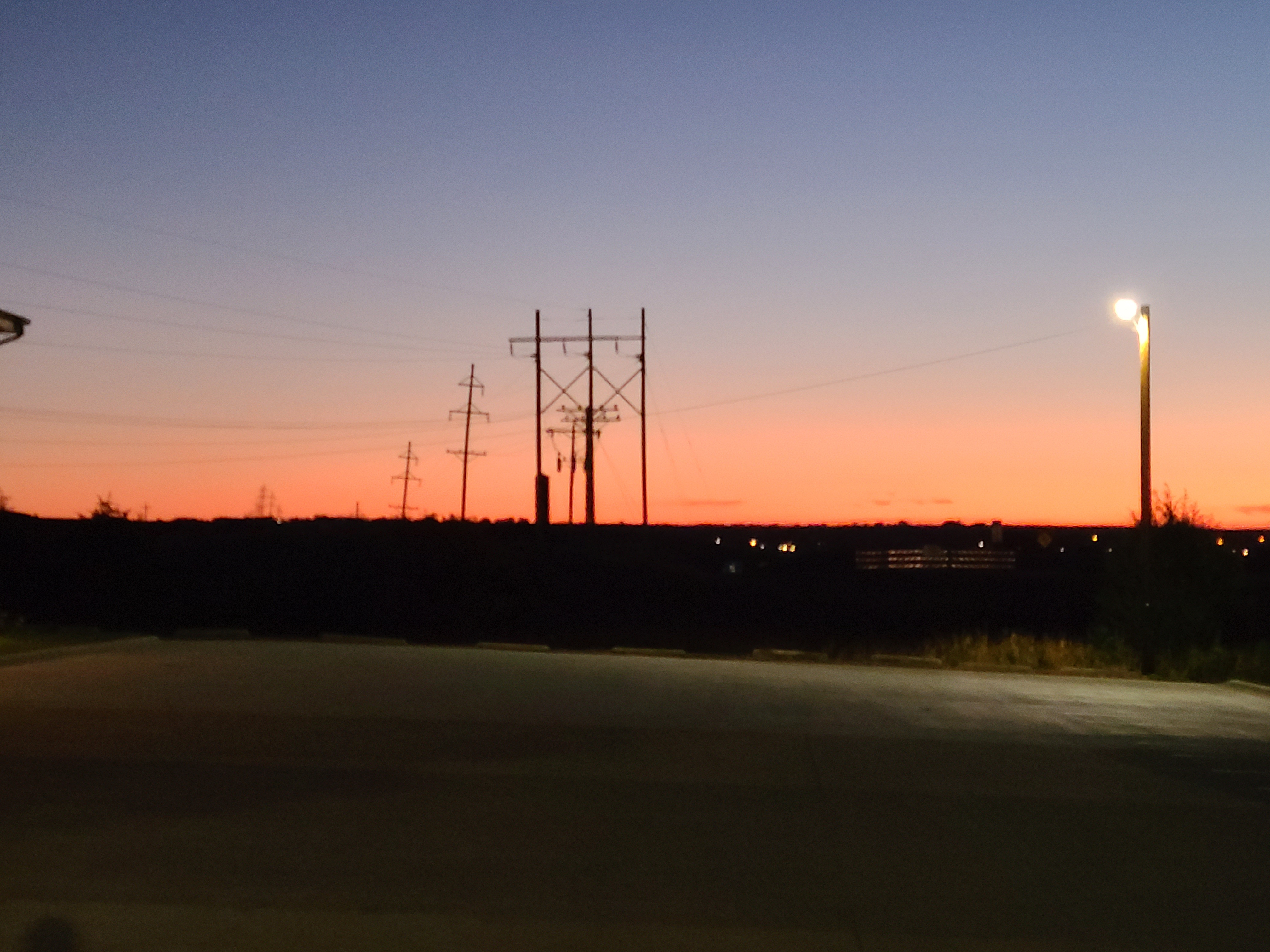
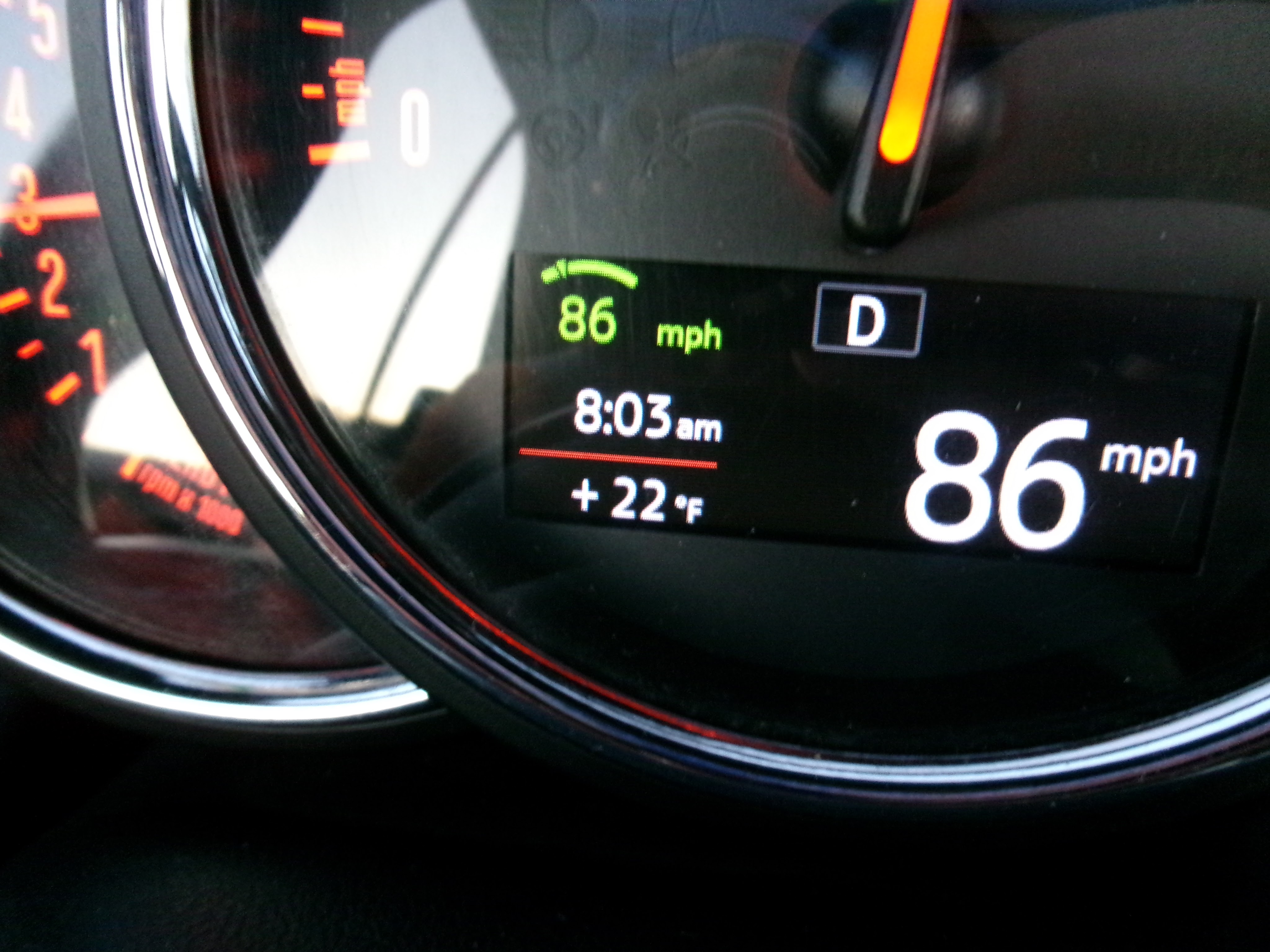
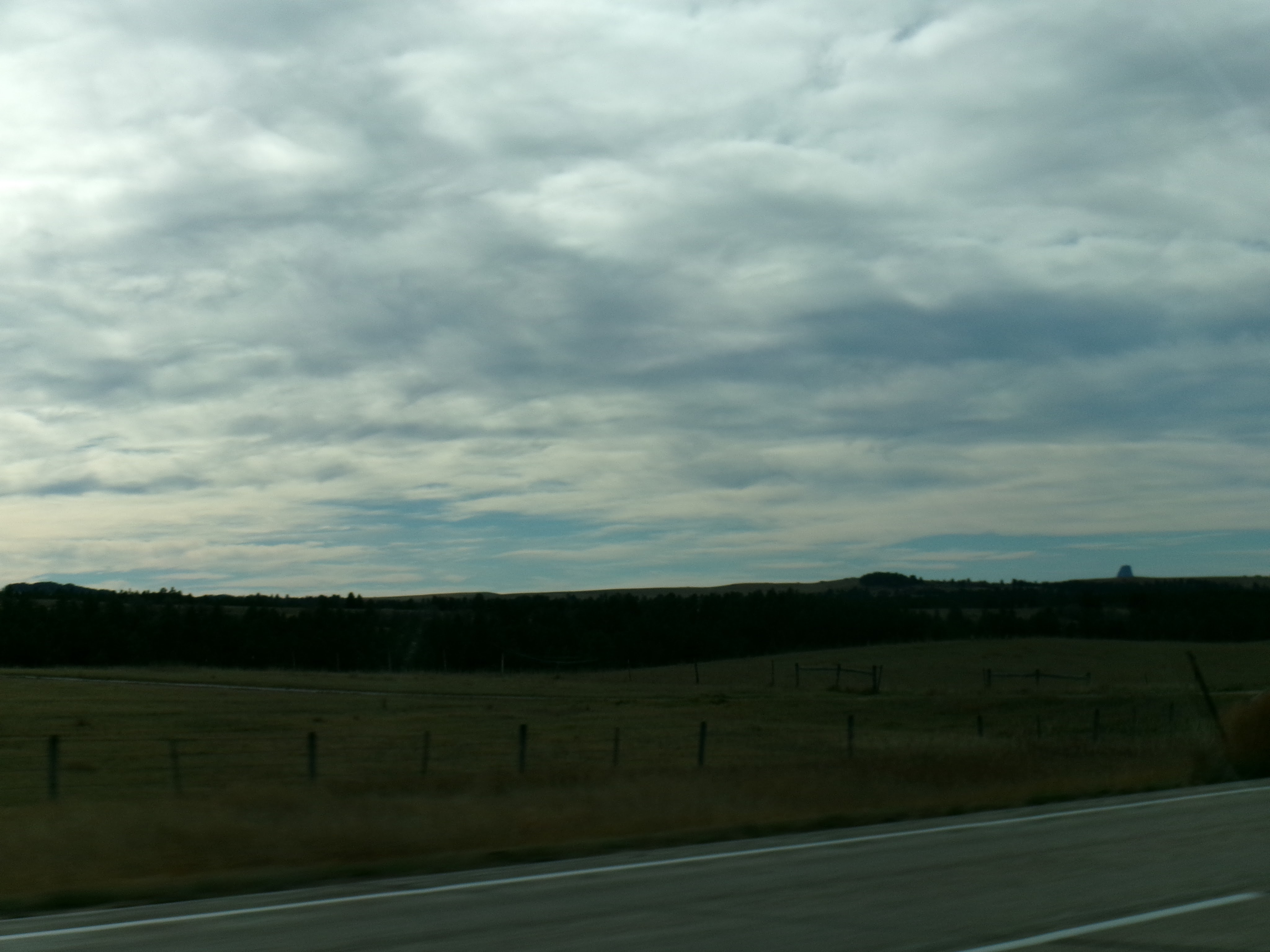
I had to get out my ice scraper. Too much frost for me to even just run the heater and use the wiper wash.This is an odd one. It looks like a sunset. But it was in the morning. And on the wrong side of the sky. Strange.Why yes, that does say 22 degrees.More snakey snakey goodness. Didn’t see any though.If you look off on the right in the distance, you can see Devil’s Tower!
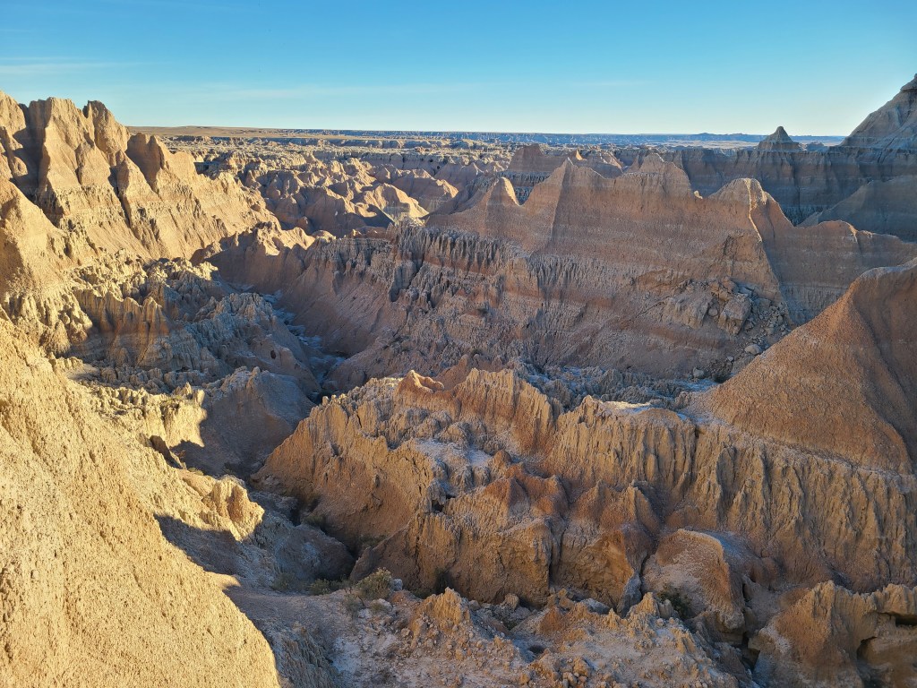
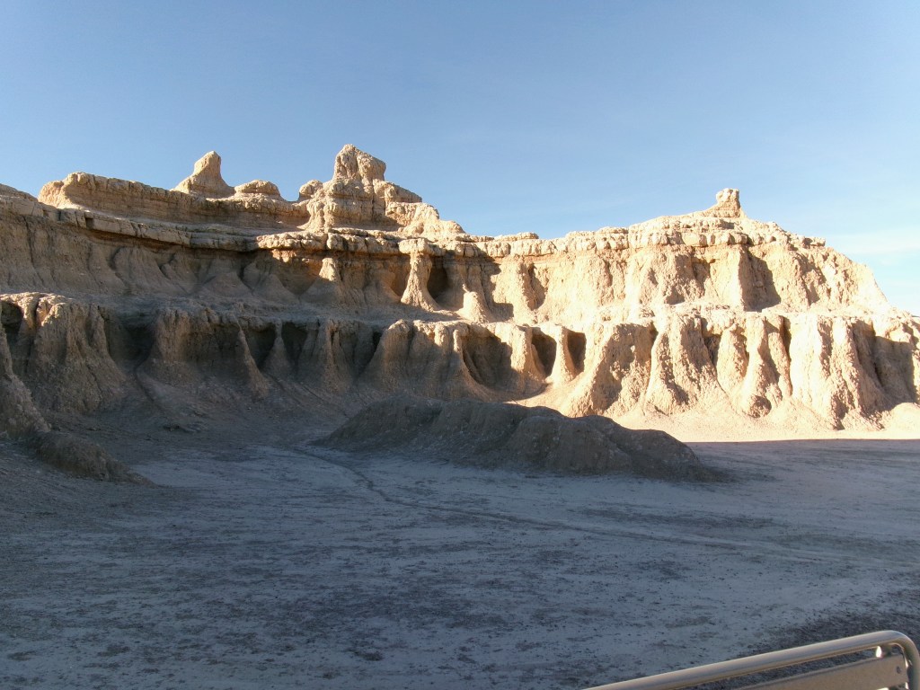
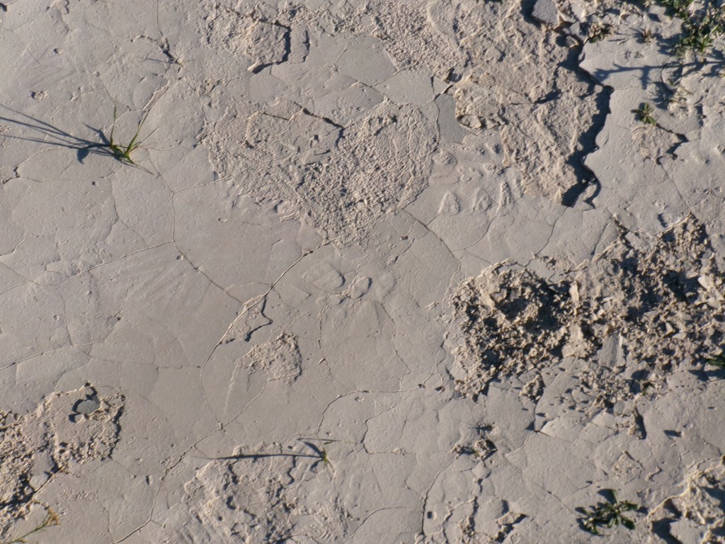
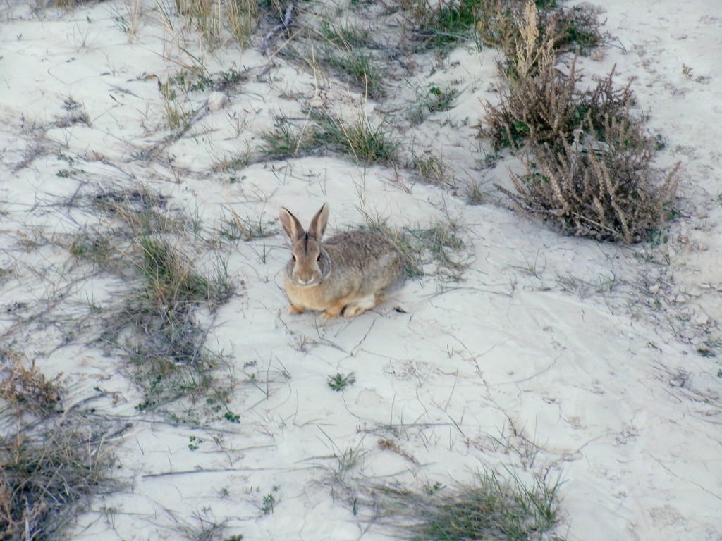
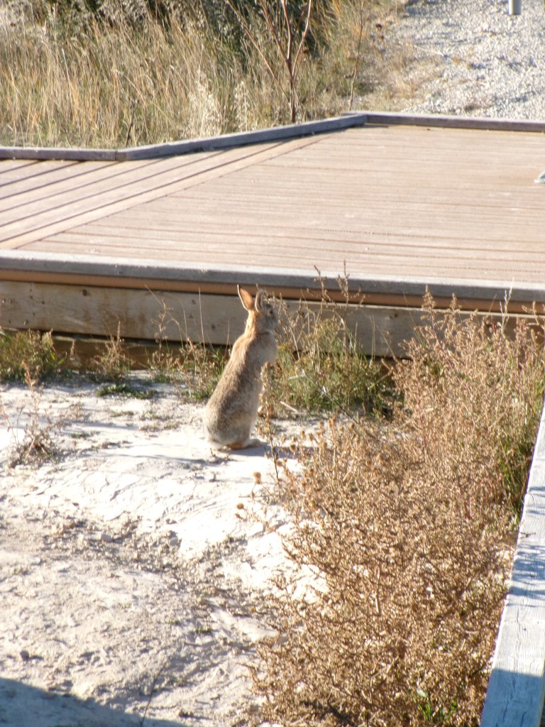
Badlands
They just go on foreverIt’s like the surface of the moonI met a little bunny. This is about 20 yards from the parking lot. There just weren’t any other people around.Here my bunny friend (we’ll call him Harvey) looks for his friends, Watership Down styleEndlessJust keep going. Imagine getting lost in there.Layers of so much time we weren’t involved in.
I said when I left my job I was going to get in my car and drive west until I found an ocean. Today I got in my car. I’ll be posting frequently, as this trip is actually considered therapy by my care team, and it’s all about reflection. Itineraries have been emailed to a friend, with contact info all around. You’ll just have to read to find out where else I end up. Enjoy!Hit the about link to the left for background.
It was a simple day. Started off familiar, as it was my home state and I had just run a test drive that way last week.
While it was rainy, it was still exciting. No hope for the top down as it was 42 to start and peaked at 55 or 51 or something. There will be plenty of opportunities in the future.
One of my snippets below is about beginning to realize the ocean is very very far away. On one hand it really is, and this is going to be a long week getting there. But on the other hand, it’s just down the road, left turn before Seattle and I’m there.
I feel like going somewhere humbles it. Disney Parks are magical until you’ve been there. They’re still great, but once you’ve been you’ve spent a lot of the magic. So I’m hoping this trip humbles not only myself, but the country I live in somehow. And the distances between the interesting bits.
Haven’t felt the depression today and just a bit of anxiety. Not much for me but might kill a normal person. 🙂 I attribute these things to the excitement of the first day. But I’m almost willing to own it, which is a crazy thought. I had a few times where I thought this was stupid and I should just go or stay home. I guess I just waited them out and kept going, not bad advice for life in some cases.
When I crested the hill and saw the Missouri river, the rolling hills, and the blue sky and clouds it was probably my first WOW moment. No doubts on the trip anymore.
Tomorrow is a tiny bit shorter, but with prettier scenery and what I understand is a Very Large drug store. I get to see Devil’s tower! Very very excited for that one!
Author’s note: I think I’ll be able to use this as a template for future days posts, which should make things easier. I’m already pretty adept at integrating the photos from google photos, so it’ll take less time in the future. Also, if you’re reading this in 2028 and the photos don’t work, it’s because google unlinked them. Or went under.
Deets
License Plates: WI, VA, IN, IA, NE, USG, SD, OH, MI, CO, TX, PA, OK, GA
States: MN, SD
Departed: 9am CDT, 42 degrees, scattered rain. (turned into actual rain quickly)
Original ETA 2:53pm CDT
Arrival: 4:00pm CDT, 50 degrees and partly cloudy with the most amazing clouds ever
Weather: Rainy morning ranging from drizzle to downpour. Rain stopped at the SD border.
Budget: Gas TBD, Food above, Hotel below
Food: breakfast latte great, lunch BLT delicious, dinner burger tasted like Mom made it. Not a good thing. Fries were decent though.
Snippets
A giant bald eagle swooped onto the road trying to get to some carrion, but flew off when I approached. I had to swerve to miss it, but the wingspan was almost the width of the road. Amazing!
I started to catch wind on I90 in Minnesota. Nothing horrible, but definately an active driving situation
By the time I got to South Dakota I felt like I was driving a curve to the right, compensating for the heavy wind.
South Dakota
I can totally get behind the 80 mph speed limit
Apparently I’m the only one
I feel like the trip has really started
What is Wall Drug’s annual marketing budget?
I have a fear of trucks losing cargo on me, and one lost an ATV door as I was about to pass him. Thankfully it flew like a kite over the shoulder. Still, fear confirmed!
Halfway into the first day and I can’t remember the Day of week
The more I drive the more I’m beginning to think the ocean is really far away
The top of my car (ragtop) feels like a horses hide, which really works nicely with the Rocinante name.
Stopped in St. Peter for coffee and bathroom break, a regular latte seemed like a custom order because it wasn’t one of their special drinks
Pictures
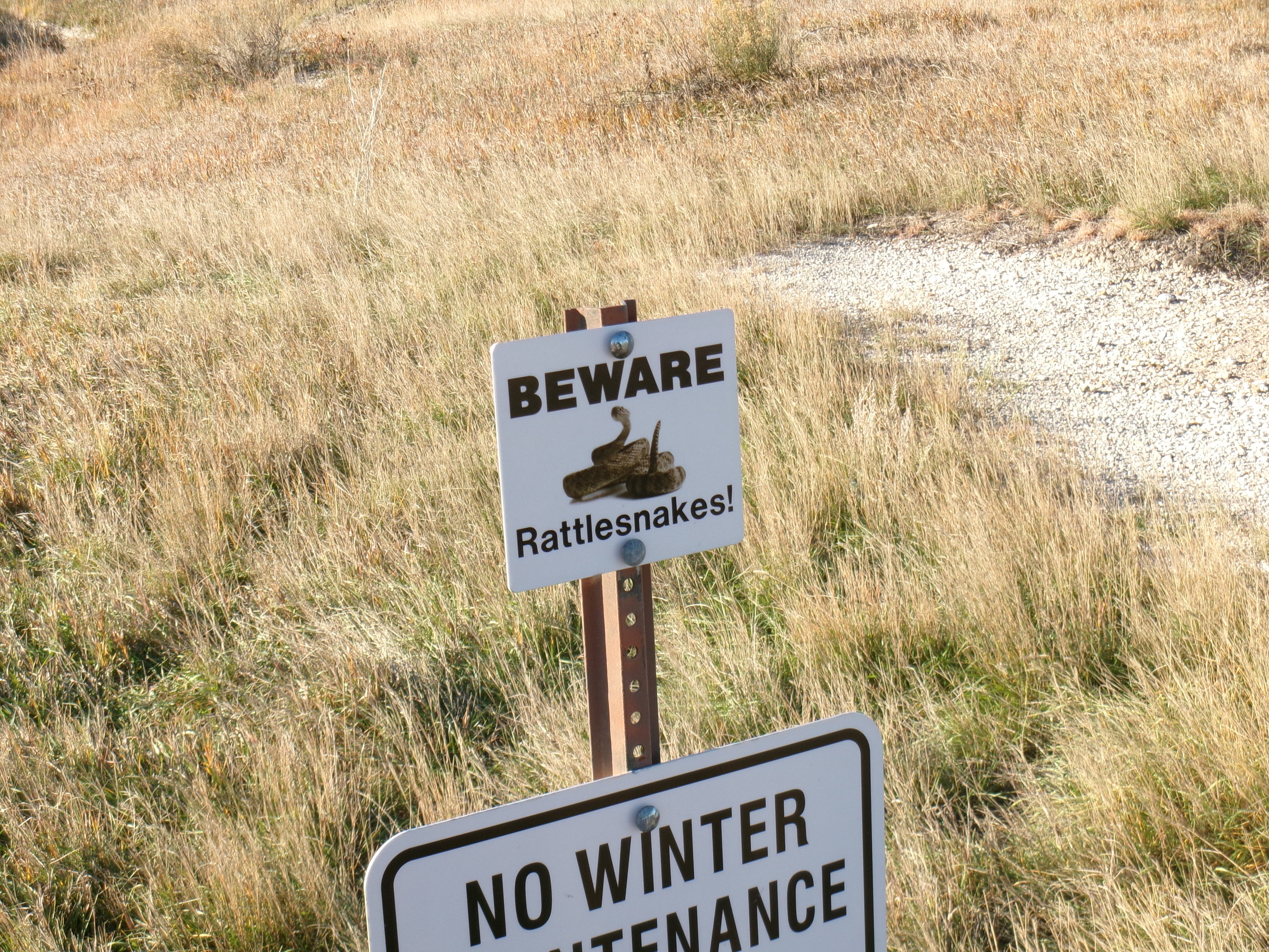
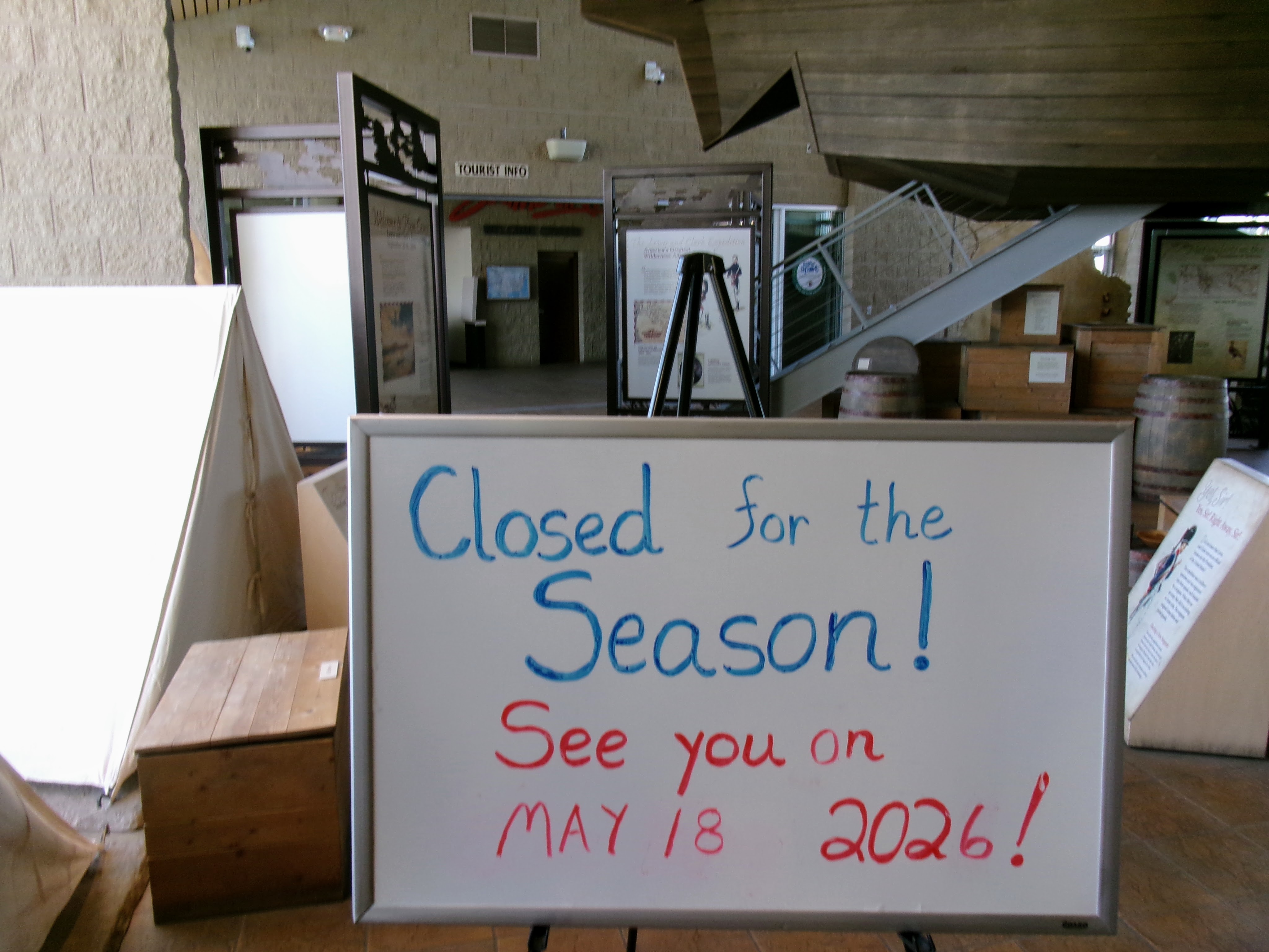
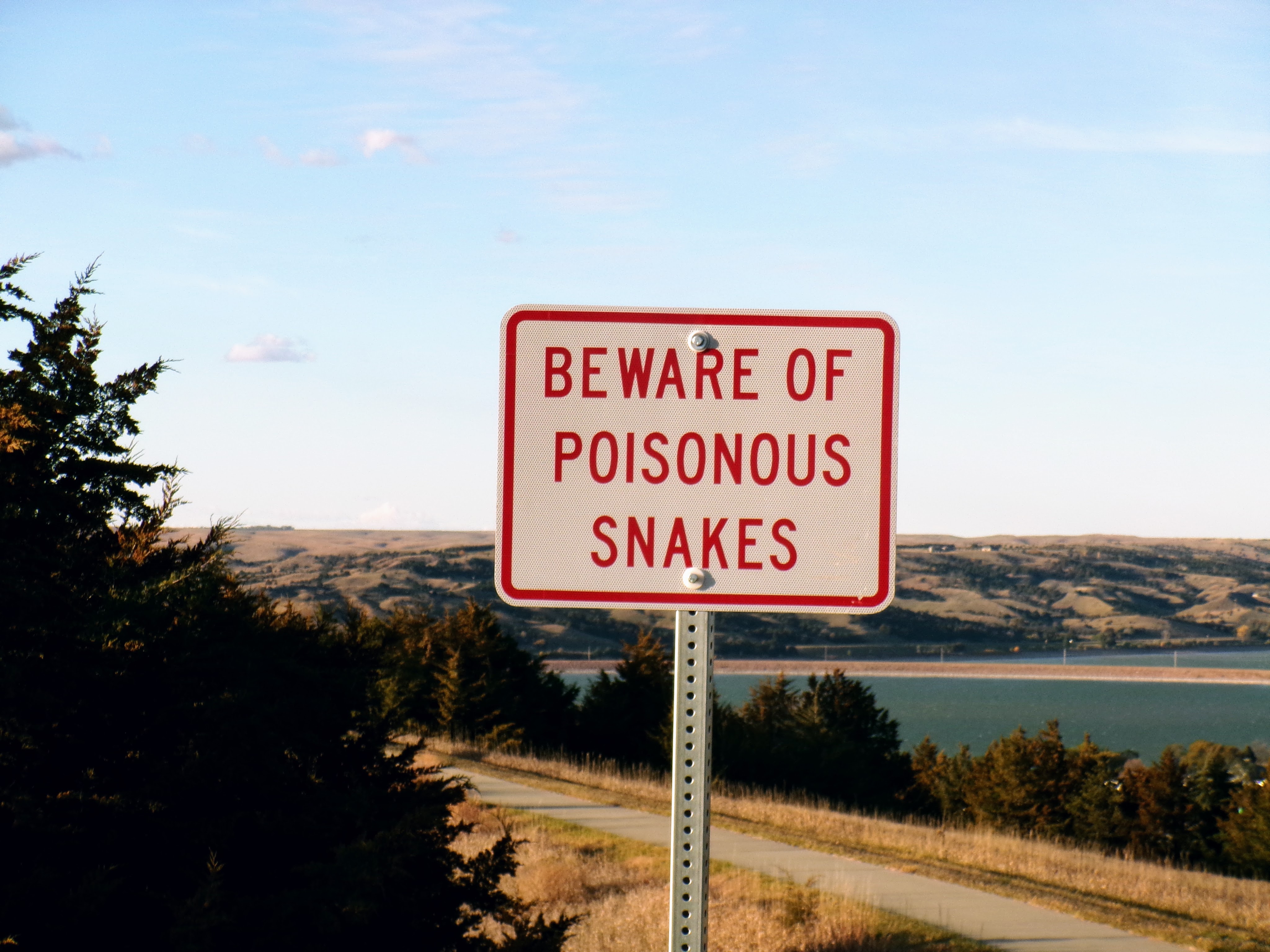
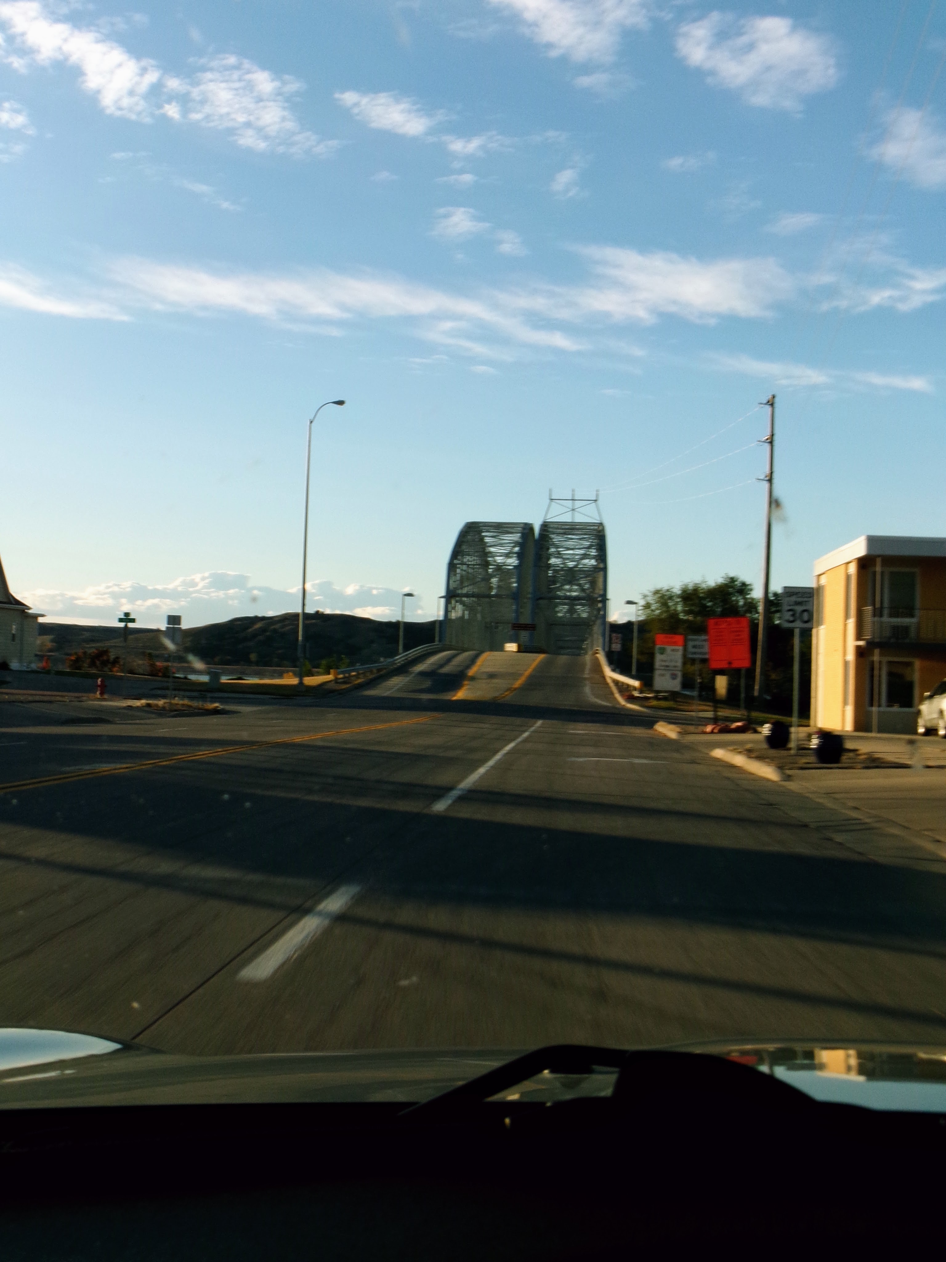
Pictures here
Welcome to my morningI wanted to stop / hotel here because it’s the Missouri river, which is cool. But also because this is one of the places Lew and Clark stopped on their trip upriver. There’s a cool museum and everything talking about the voyage. Which apparently has a season. Boo hoo!I was very excited to see this sign! On one hand, it’s crazy that one could run across one of them in the wild. On the other hand tasty tasty death danger! (Low SI day except here and once crossing the river.)I’m sure it’ll happen again, but I was shocked (SHOCKED!) at the hills and how not flat they were. That’s also the river right there, which of course is super cool even if it thinks it’s the longest river in North America. (It’s not.)This is the second bridge over the river in these towns. It was fun to drive across (twice!) and pretend I was Rain Main. Also, it’s a widely held belief that Lewis and Clark stopped in this area because this bridge and the Interstate 90 bridge both made it easier to get across the river,